Corpis Maps
Unique Configurable Analytic Maps
Corpis Maps is a unique configurable map application for spatial analysis of any data. The application enables intergration with any information systems (e.g. ERP/CRM/BI/E-commerce).
Main Features
Corpis Maps is a leading geospatial analytical application that enables to analyze any kind of data (e.g. sales, marketing, e-commerce, safety, insurance and banking industry, transport, ...), get the maximum information from the data, is easy to use and has a right mix of proven and new unique features.
Rich Data Visualization
Simple and complex points, clusters, heatmap, cartograms, cartodiagrams. All in one place.
Maps and Charts
Interactive maps, charts and time series provide deep insight and lots of useful information.
Data Security
We can guarantee 100% security, because your data will never leave your applications and servers, when using Corpis Maps.
Configurable
Simply create your analytical map using one configuration file. The configuration file can be changed anytime based on your needs.
Geocoding
We can convert addresses (in some countries) stored in your corporate system to coordinates.
Filters and Search
Full-text search with advanced filters enable to show a specific part of data in the analytical map.
Integration
Corpis Maps can be integrated with any ERP, CRM, BI, E-commerce or any other system.
When integrated, users will get a great new funcionality in a form of advanced spatial analysis and easy-to-read data visualizations in maps, new insight and information about projects, orders, products, revenue, and other important metrics and phenomenons.
ERP
Enterprise Resource Planning - is the integrated management of core business processes
CRM
Customer Relationship Management - is an approach to manage a company's interaction with customers
BI
Business Intelligence - allows a company to analyze corporate data to aid in decision-making
E-commerce
Systems that enable buying and selling of goods and services over the internet
Corpis Maps
Examples
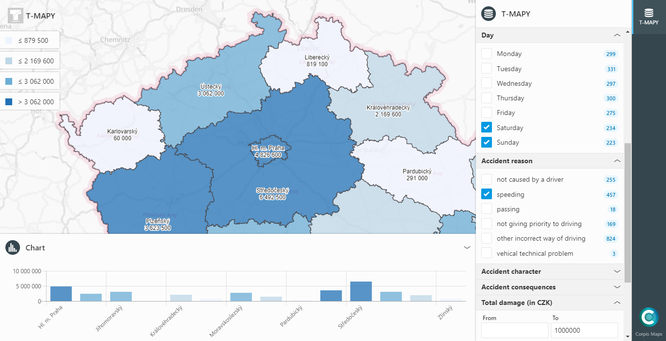
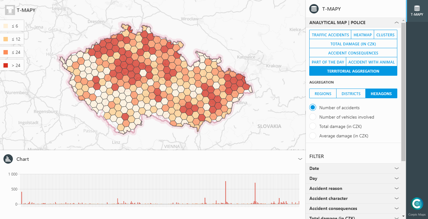
Spatial analysis of country regions

Data visualization by category

Detailed information about every point in the map
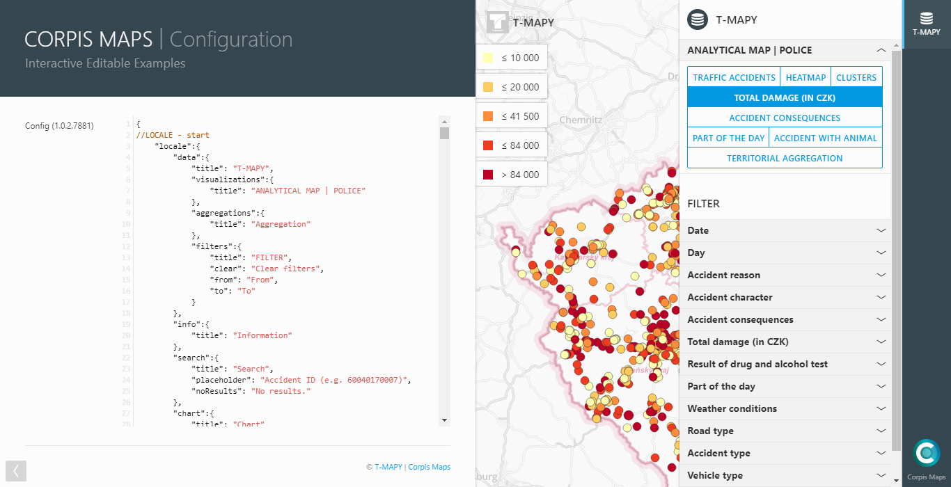
Configuration of a map application
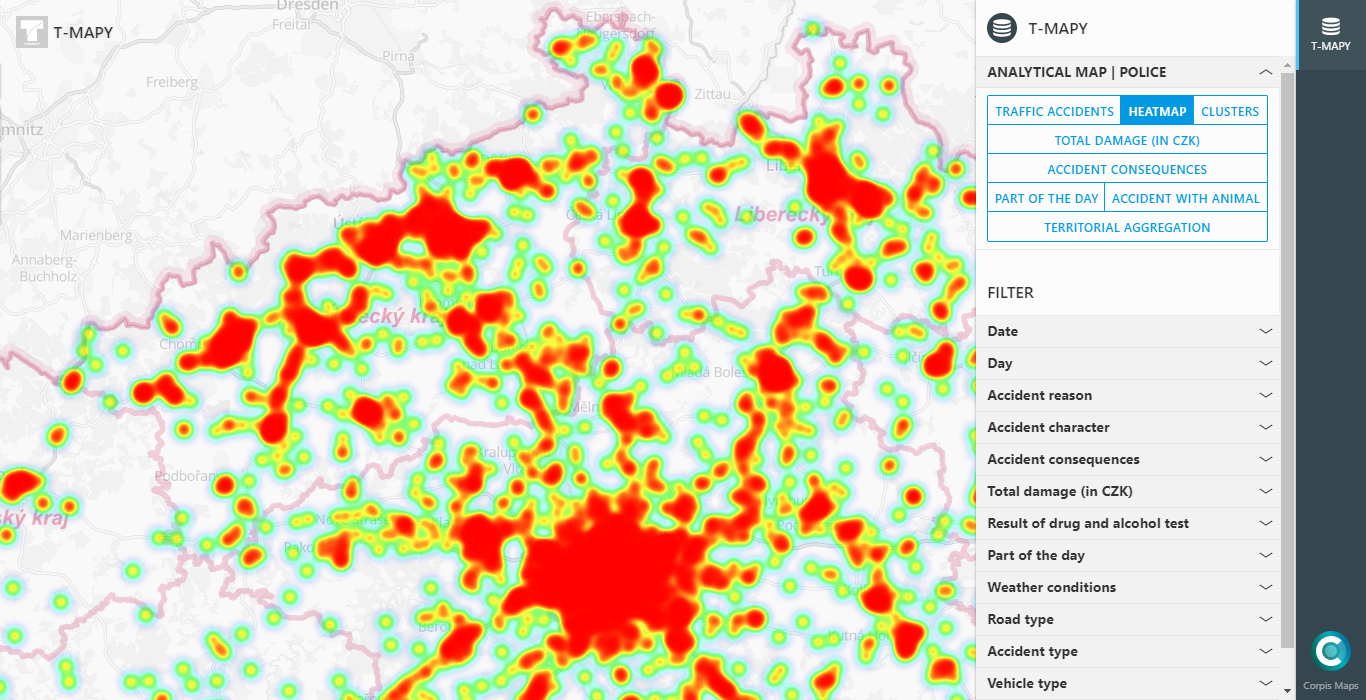
Visualization of data in heatmap