Water Supply and Sewage Systems
part of the Assetino product suite
a simple and effective solution for management and administration of water mains and wastewater networks
Assetino Water is an application for the management of water and wastewater networks, designed to support the complex administration of water and sewer lines managed by a city, municipality, or an authorized organization.
Main Features
manage data and keep the records of your water and wastewater systems, as well as related facilities and equipment
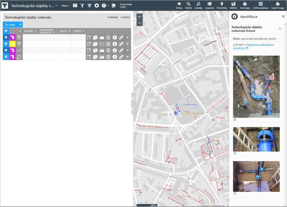
display specific objects on the map and edit them
look up a chosen object based on its attributes
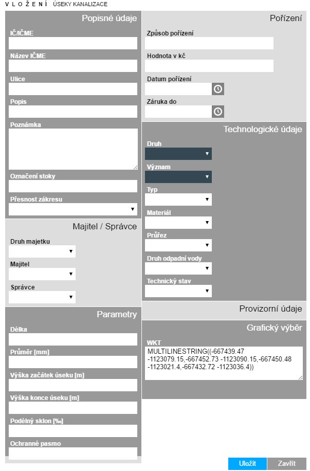
edit existing objects and add attributes
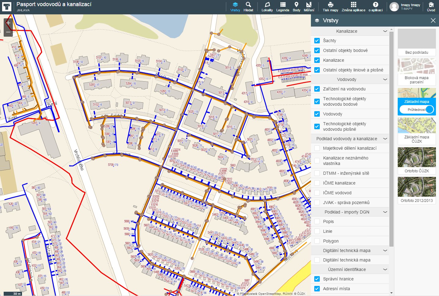
display and edit specific app features in the map
keep track of repairs performed on specific objects and get notified about approaching warranty expiration dates
Main Advantages
controllable access to data
Information stored in the application can be made accessible to as many internal/external employees of your organization (either for editing or for viewing purposes only) as you desire. Some information can also be made available to the public.
fast editing tools
The application contains menus with numbered options, which are prefilled for most attributes. An authorized administrator can edit the numbered options to suit the organization’s needs.
user-friendly interface
Users need just a computer or a tablet with internet/intranet access and a standard web browser to use the application.
support for data transfers
The application includes tools for exporting and importing data saved in database format to ESRI Shapefile format as well as for importing DGN files. Basic attributes can also be exported to CSV, XLS, XML, and XHTML formats.
integration with GIS
Editing the location of individual features in the map takes place directly in the map section of the application. Editing tools are available for lines, areas, as well as polygons.
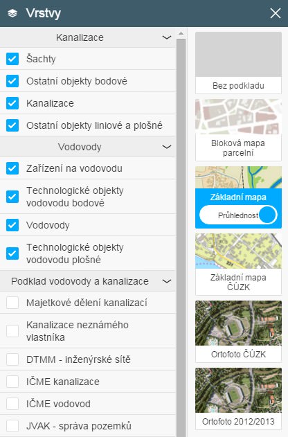
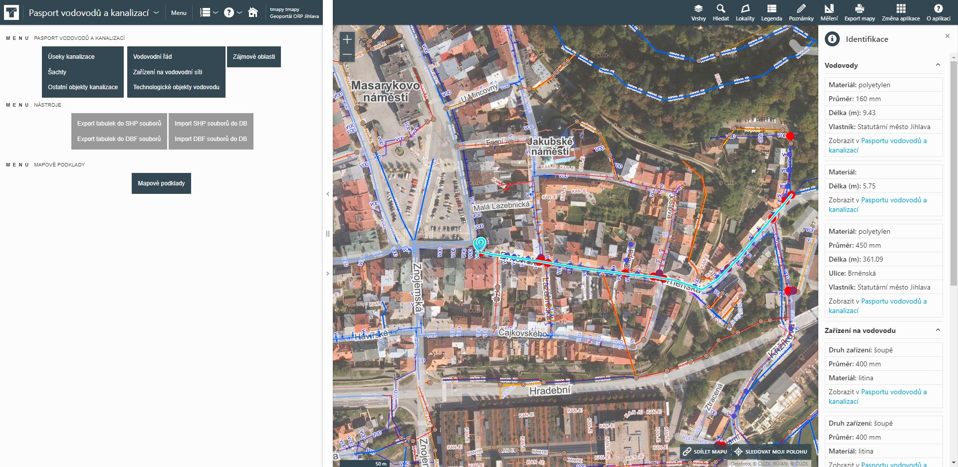
Database Section of the Application
The database section of the asset management contains modules which focus on specific areas and enable separate editing of each individual topic.
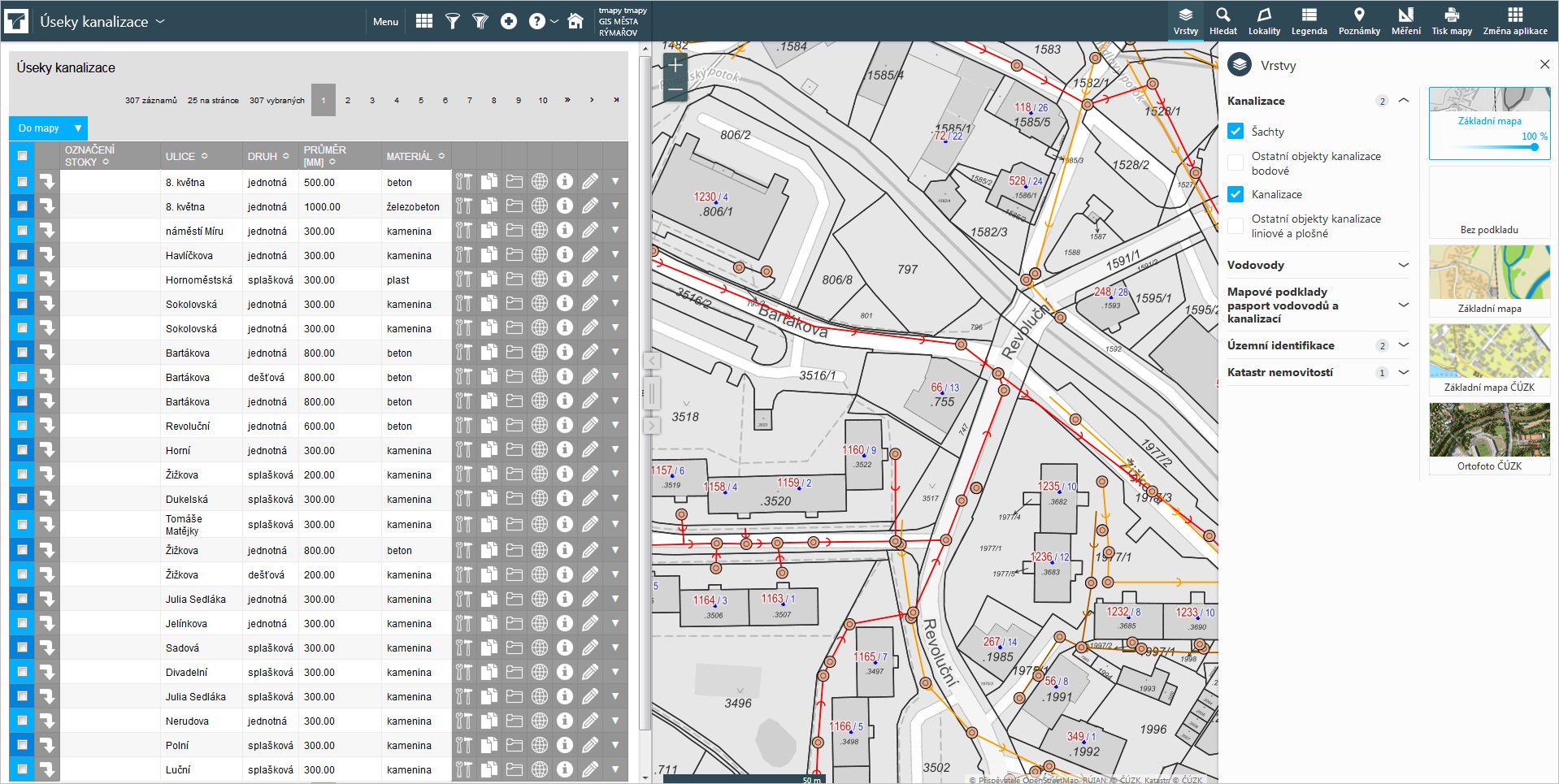
Sewage networks
- sewage network sections + repairs
- sewage network shafts + repairs
- sewage network objects + repairs
Water lines
- water mains + repairs
- water system equipment + repairs
- water system objects + repairs
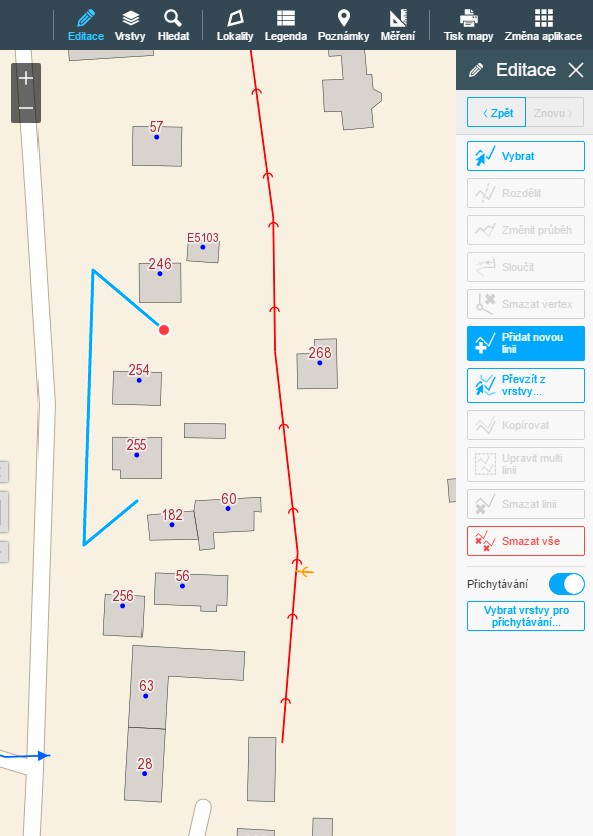
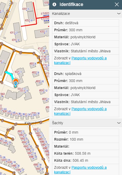
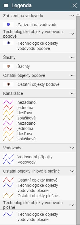
Map Section of the Application
Tasks enabled by the map section of the application include:
- displaying individual features and descriptions and information related to them in the map
- displaying individual topic layers (categories) of objects, including a dynamic legend
- full-text search for streets, addresses, or plots of land
- displaying locations of interest in a particular area (if they are defined)
- editing – e.g., adding, modifying, or removing points of interest, lines, or areas (polygons)
- creating symbols for objects and equipment on water and wastewater networks (using pre-set symbols and colors)
- measuring distance and area size
- simple note-taking
- printing options