fúze_hero

Further growth of T-MAPY in 2021

In 2021 T-MAPY confirmed its strong position as GIS leader in the Czech Republic and Slovakia by two significant acquisitions. It became a major shareholder of GRID and MAPA Slovakia Digital.

GRID is a Prague-based geodetic survey company. It is one of top Czech specialists in engineering surveying and mobile mapping. "Combining the know-how of these two companies will bolster our expertise in the field of digital technical maps, 3D GIS, building information modelling (BIM) as well as Automated Mapping/Facilities Management (AM/FM)”, says Jiri Bradac, CEO of T-MAPY and the new Executive Director of GRID.

T-MAPY expanded its activities to Slovakia in 2014. The growing number of local customers resulted in establishment of an independent company, T-MAPY Slovensko. In 2021 MAPA Slovakia Digital was merged with T-MAPY Slovensko, becoming T-MAPY.

Jan Gasparek, Executive Director of T‑MAPY s. r. o., points out: “We welcome this union and believe that together we will be stronger in business operations. T‑MAPY will now be able to take advantage of a wide range of synergies, bring unique products to the market, and further increase the quality of services we provide.”

1

The GIS of the City of Brno - 16 years of consistent development

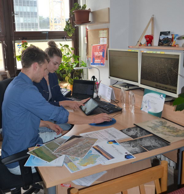
September 2021 marked 16 years since one of the most advanced and robust geographical informational systems in the Czech Republic started taking shape – The GIS of the City of Brno (GISMB).

The GISMB was designed and developed by the GIS Department of the Brno City Municipal Authority. The core of the system was created in 2005, the first web application was launched in 2006. We are very proud that the City of Brno has chosen T-MAPY company to be its partner in creating this great municipal GIS.

2_mini
3

GISMB is based on linking common data with their spatial location within the city limits. This allows users to work even with data that are seemingly non-homogenous and otherwise unlinkable, thus providing a completely new and often unexpected perspective. For example, if we link data describing the age structure of citizens with their place of residence and take into account how this data evolved over time, we can make better plans for school locations or retirement homes.

dana

RNDr. Dana Glosová

GIS Department Manager, Municipal Authority of the City of Brno

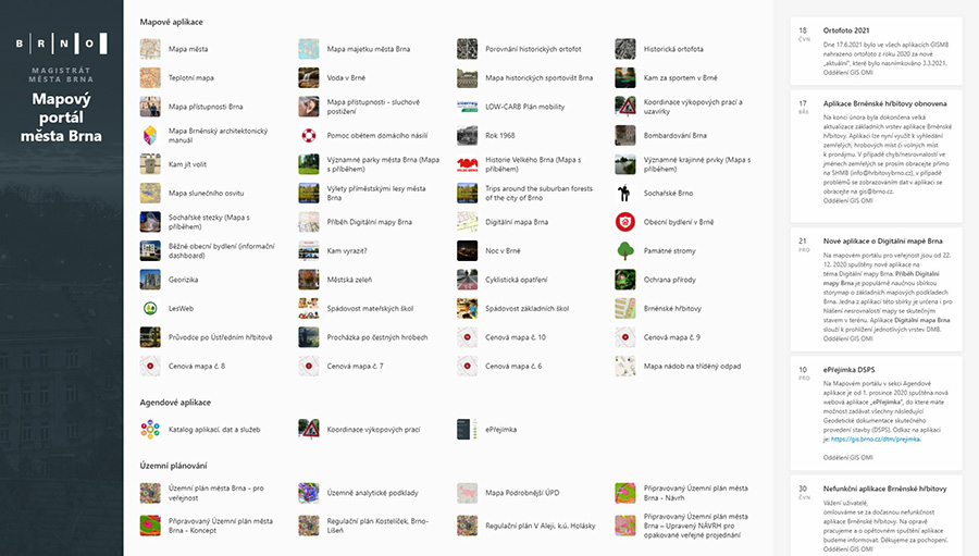
Since 2005, the whole system has undergone multiple changes and after years of continuous development, it now looks completely different than in the beginning. Currently it includes roughly 240 applications, both internal as well as those intended for general public.

GISMB_m

GISMB - one of the most advanced and robust municipal GIS in the Czech Republic

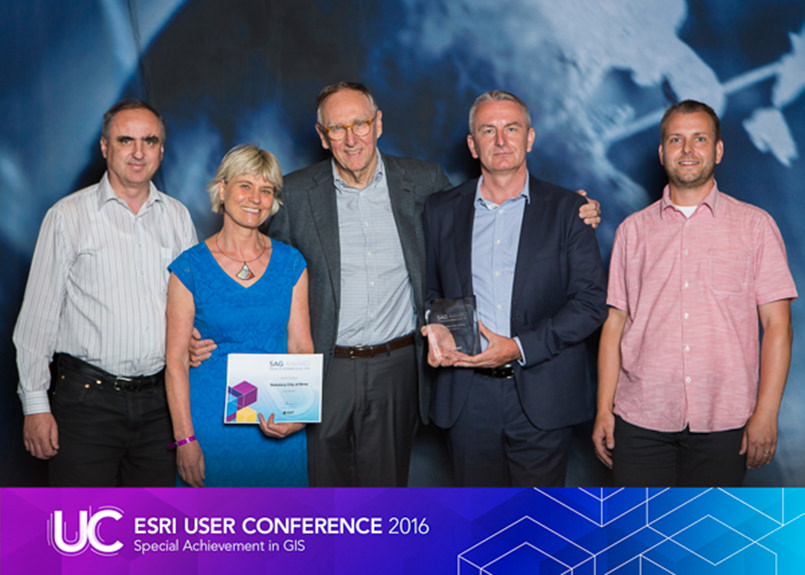
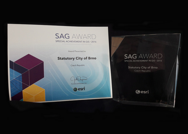
GISMB has been acknowledged abroad as well; in 2009 and 2015, the City of Brno received a prestigious award at the global Esri Conference – the ESRI SAG (Special Achievement in GIS) award.

SAG_img1
SAG_img4_mini

The best value of GISMB is that it is being used on daily basis by hundreds of workers of the municipal and other local authorities, various city organizations, and is gaining more attention within the public as well.

public map applications_m

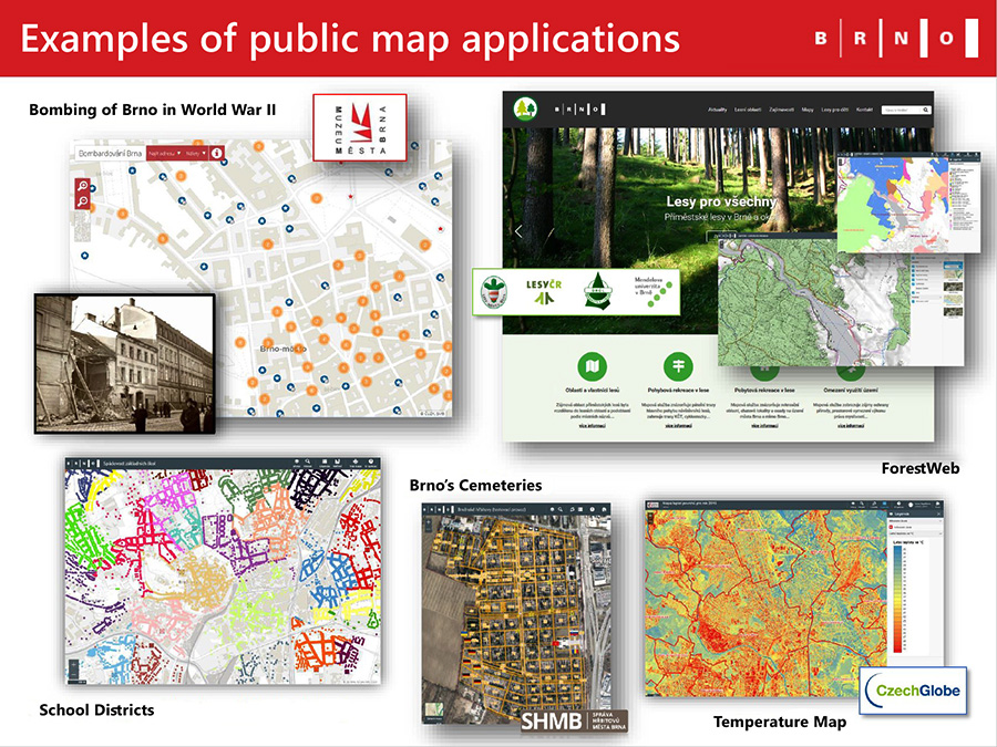
Examples of applications for the general public – from the GISMB presentation (author Dana Glosová)

Which GISMB applications are the most popular? Among the internal apps the most frequently used are those related to the cadastre and land registry, city properties and digital technical maps. Public users are usually interested in applications referring to zoning plans, Brno’s cemeteries and roadwork; applications displaying historical aerial photographs and the map of participatory budget are also popular.

Needless to say, more and more of these applications are approached from tablets and mobile phones.

umbrella_street_lights

Assetino Lighting - more than a list of street lamps and poles

Assetino Lighting is a web-based data management and visualization solution. Its easy-to-use interface and sophisticated tools are designed to help local authorities and other organizations store, manage and display all street lighting-related data (switchboards, poles, cables, cable cabinets, lamps etc.).

The application is used by numerous municipalities in the Czech Republic and Slovakia. In addition to the apparent daily assignments, the office workers use Assetino Lighting to help them with other tasks. Below you can read more about some of them.

Valid data for strategic documents and grants requests

Street lighting is a very important part of every local government agenda. Furthermore, it is technically and financially demanding - strategic planning of this area is therefore crucial. Assetino Lighting provides accurate and up-to-date data for various strategic documents and grant proposals. It also represents a well-suited environment for strategic data display.

pvo_generel_hk_m

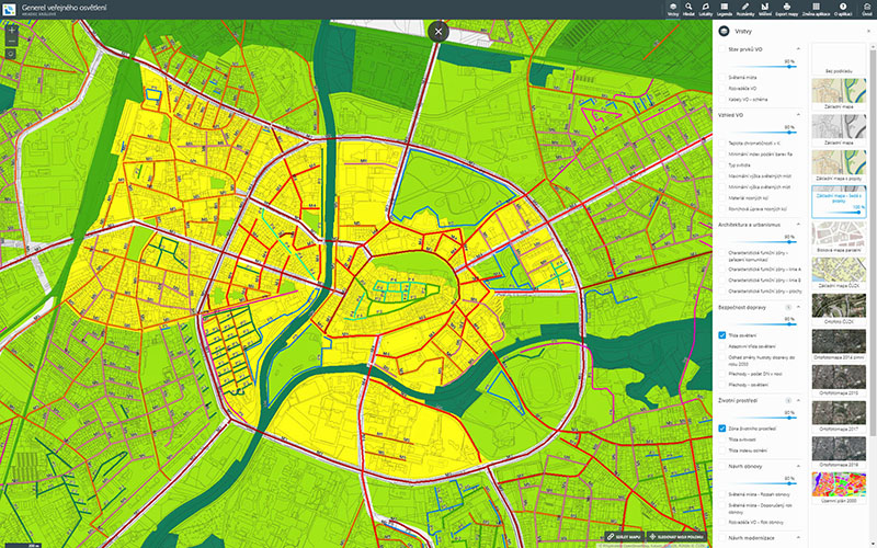
The image shows a public map application displaying the Street Lighting Strategic Plan of Hradec Kralove City.

Up-to-date data for city engineering maps

Any municipal government of a larger city should have a detailed engineering map at its disposal. This large scale map displays numerous data layers, therefore bringing it up-to-date is a time-consuming process (which is usually carried out annually). Since Assetino Lighting is used on a daily basis, it represents a great source of relevant information on electric cables, poles, lamps etc.

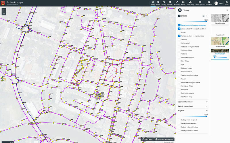
For the city of Havlickuv Brod we set up an automatic interconnection between an Engineering map application and Assetino Lighting. It allows for an effortless comparison of electric cable outlines in these two data sources.

pvo_dtmm_hb_m

Interconnection between Engineering map application and Assetino Lighting provides an instant comparison of electric cable outlines in these two data sources.

Christmas decoration and other objects installed on street light poles inventory

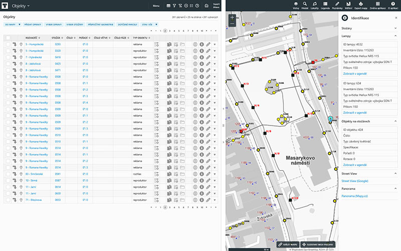
There are many objects attached to or suspended from street lights: loudspeakers, traffic lights, cameras, advertising banners, hanging planters etc. To keep records of such objects Assetino Lighting provides a special module called “object register”. Besides systematized data administration it allows its users to create their own object types. For instance, in Klasterec nad Ohri it is used for Christmas street decoration planning.

pvo_objekty_jihlava_m

Assetino Lighting allows for an easy inventory of various objects: loudspeakers, traffic lights, cameras, advertising banners, hanging planters etc. The image shows how they use the objects register module in Jihlava City.

Smart City ready

For the cities that want to fully employ modern technologies, we offer Smart Assetino Lighting. This special extension interconnects Assetino with various online data transmitters (IoT sensors) attached to street lights. The integration allows Assetino users to visualize and analyze street lighting consumption, temperature of individual lights and other values. It also provides tools for remote control and efficient maintenance of the whole street lighting system. Find out more about our Smart City solutions!

globe_1

Prestigious International Award for Jack Dangermond

Jack Dangermond, Founder and CEO of Environmental Systems Research Institute, Inc. (Esri), received the Planet and Humanity Medal from the International Geographical Union (IGU). This award is only given every four years to people who have made contributions in the political or policy community that have impacted the world in a positive way. Jack Dangermond is the first person in the private sector to receive this prestigious award.

Jack-Dangermond-1m

Esri's founder, Jack Dangermond, was awarded the Planet and Humanity Medal by the International Geographical Union. Jack Dangermond has done more to advance geography and create opportunities for its employment than any individual in history, says IGU in its 2021 Awards Announcement.

Jack Dangermond is a longtime advocate of geography and GIS tools that enable the use of geographic knowledge in many areas of human activity. He says, "Geography helps us to better understand and solve the current problems of the world.” In response to the award, Jack expressed gratitude to all GIS users saying that the IGU was honoring their collective work in advancing GIS over the past decades. “Today, GIS is helping professionals from virtually every field apply geographic science and thinking to their work. This is impacting hundreds of thousands of organizations; helping them understand, make better decisions and in turn contributing to almost every aspect of our modern society. GIS is ultimately making the world a better place.”

We add our congratulations and agree with Jack's words from the bottom of our hearts. At T-Mapy we also believe that geoinformatics helps us to create sophisticated information that can significantly improve our decision-making. This contributes to building and planning more sustainable cities, regions and, in general, improving the environment for all of us. You can find more information about our SmartCity concept on our website.

investice

Map of City Strategic Plans

A public interactive Map of city strategic plans is a smart way to share information on how public money is spent.

Copyright © 2024 | T-MAPY spol. s r.o.