1

Project Get It Sorted Successfully Delivered

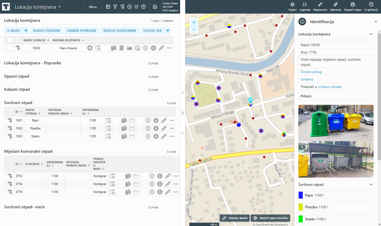
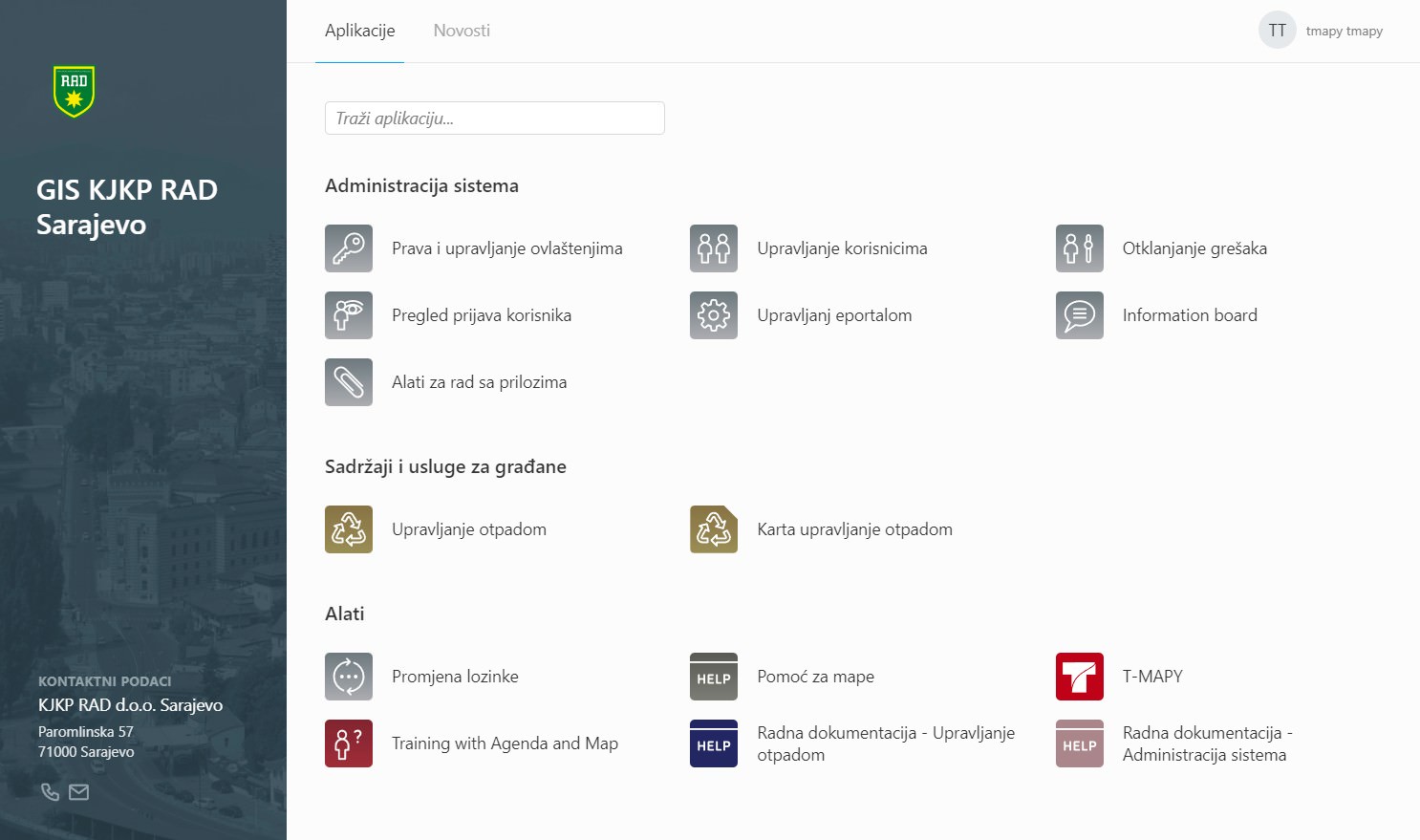
On the occasion of the final phase of the project "Get It Sorted - data-based waste management and decision- making system for Sarajevo (GIS Sarajevo)", all the results of the project were officially handed over to KJKP RAD, as the final beneficiary of the project.

Sarajevo1

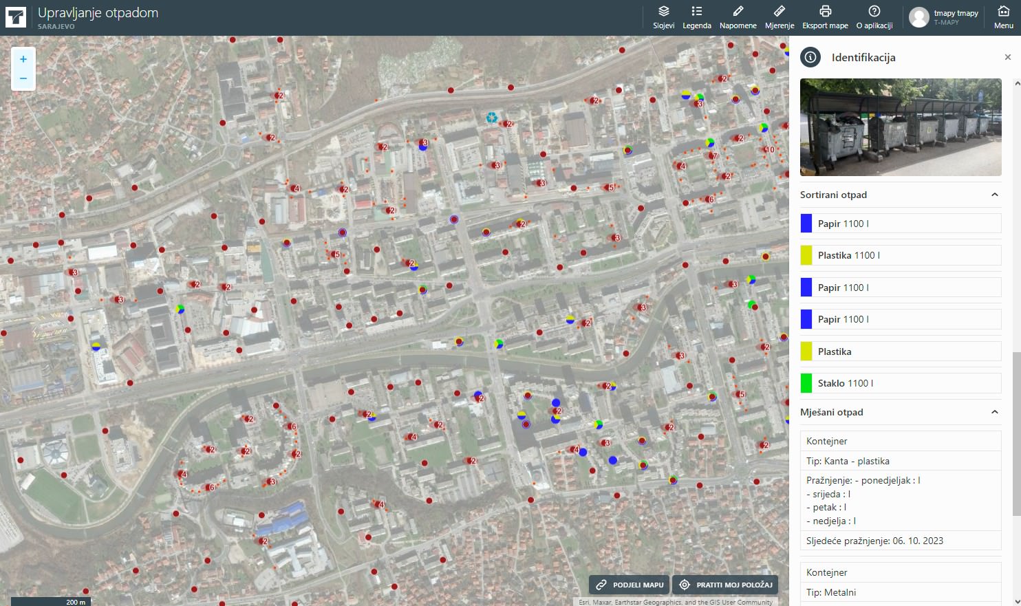
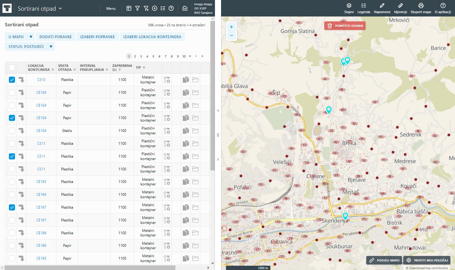
The main goal of the GIS Sarajevo project is to develop a modern solution for managing resources and assets (Asset management) based on the Geographical Information System (GIS) for KJKP RAD. This initiative aims to improve capabilities in smart management solutions, maintaining records of assets and other resources, and providing decision support based on up-to-date data and future development for all participants in the waste management system in Sarajevo Canton.

Sarajevo2

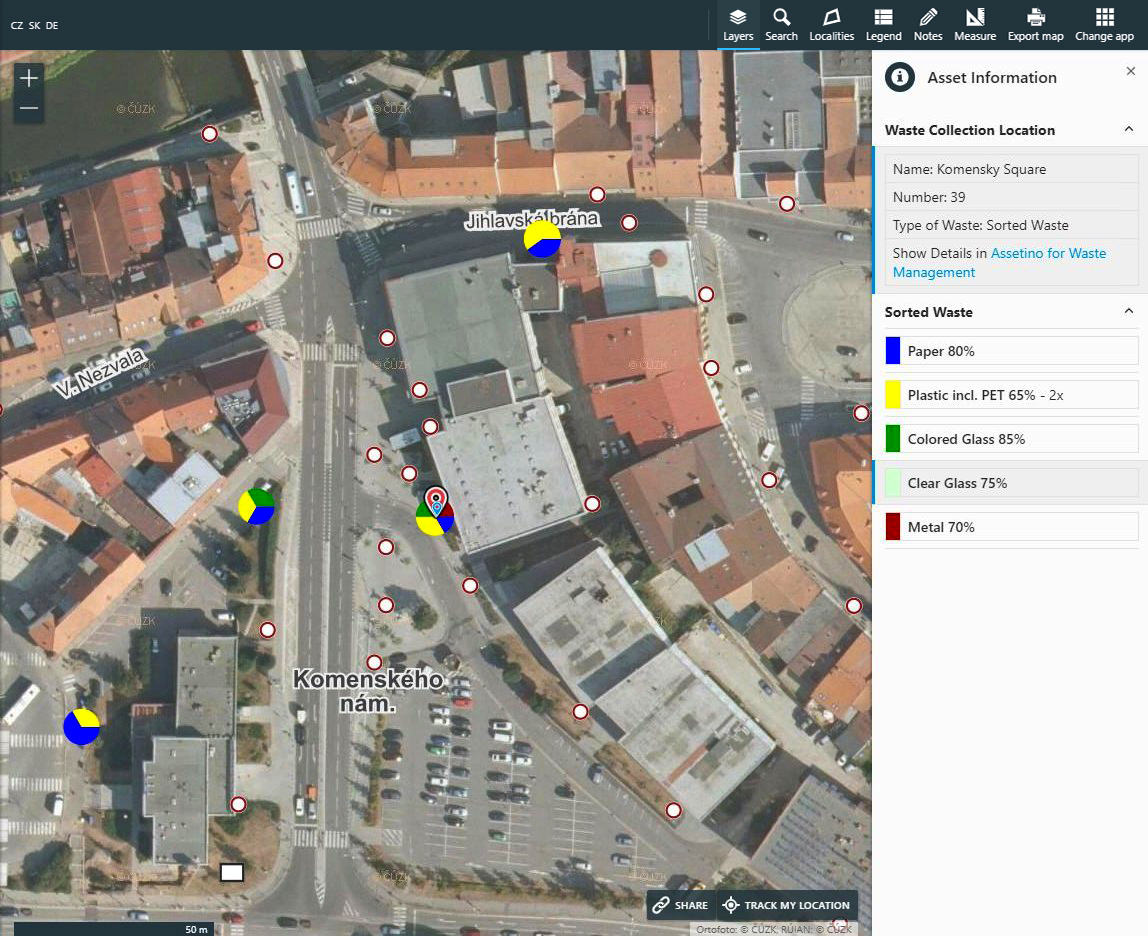
Within the system, there is also a section intended for the public, which at the current stage contains an overview map of green islands, locations of containers for mixed waste and recycling yards with information on collection times, types of waste and other useful data. This part of the system also allows the public to be informed about the periodic installation of bulk waste containers or emergency measures and temporary restrictions.

sarajevo3

Work on the system lasted throughout 2023 and represents a significant step forward, because in addition to new opportunities for quality management of resources and services and significant simplification of the work of certain services, it lays the foundations for further development of the waste management system within the KJKP RAD, future integration of GPS solutions , automatic reading of the degree of container filling, process automation and other smart solutions. The system was created on an open source basis and enables the integration and exchange of data with other services of the Canton of Sarajevo for the purpose of implementing complex smart city solutions (Smart City).

sarajevo4

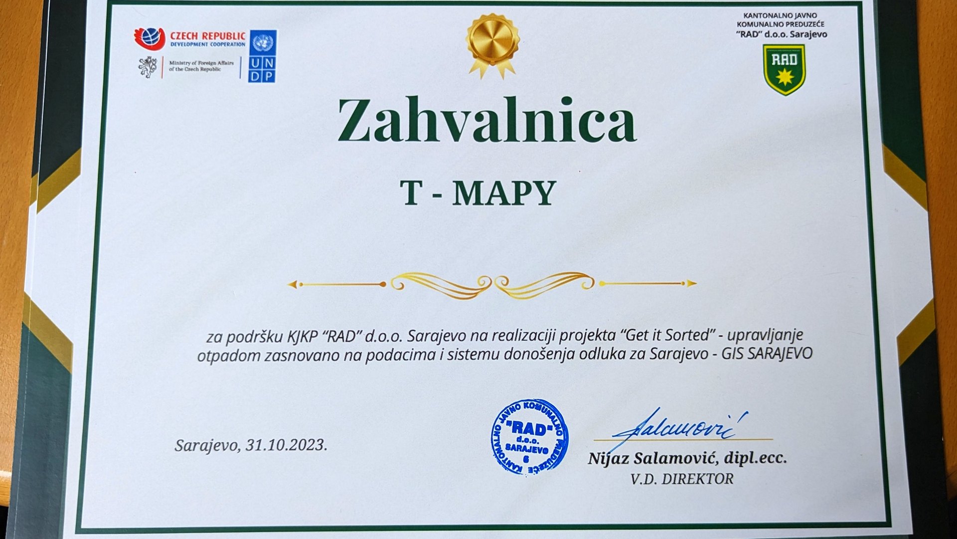
The project was implemented within the framework of the Czech-UNDP partnership for sustainable development goals (SDGs) and the contractor is the Czech company T-MAPY. Financial support for this initiative was generously provided by the Ministry of Foreign Affairs of the Czech Republic. The main goal of the CUP program is to use Czech know-how and innovative solutions to support the Sustainable Development Goals (SDGs) in partner countries. The total budget of the project was 70,000 USD, while the financial support of the CUP program was 39,900 USD.

loga

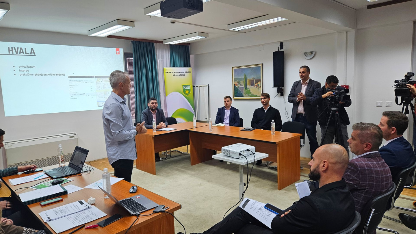
The formal presentation of the project results, including a detailed presentation of solutions, project results and future plans, was held on Tuesday, October 31, 2023. Key representatives of Sarajevo Canton, UNDP, Embassy of the Czech Republic in Sarajevo, KJKP RAD and T-MAPY participated in this event.

1
2
3
4
5
zahvalnica
6
7

The project was financed by the Challenge Fund: Czech Solutions for SDGs, an effective driver of innovation and change in the region.
osn

T-MAPY engages in Challenge Fund Project in Bosnia and Herzegovina

Challenge Fund is an activity of Czech-UNDP Partnership for Sustainable Development Goals (SDGs). Its main objective is to bring Czech expertise and innovative solutions for SDGs to partner countries.

new-CF-projects-e1671444168682

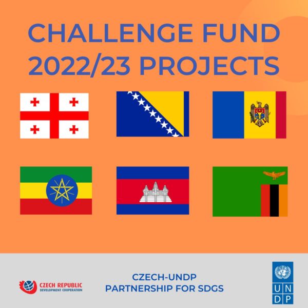
Challenge Fund Projects 2022/23

sdgs

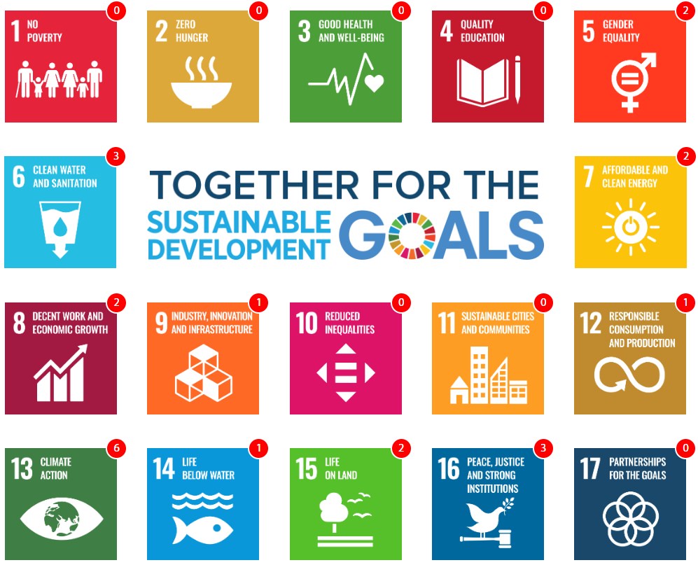
Sustainable development goals

Last year, the Challenge Fund received a record number (69) of applications. T-MAPY was among twelve innovators selected to carry out their submitted proposals. Within our project we will provide a data-driven smart waste management system for the Canton of Sarajevo, Bosnia and Herzegovina.

The system can also serve as a foundation for other smart city management solutions in the country.

waste3

T-MAPY Waste Management

The Czech-UNDP Partnership is based on the idea that many countries are facing challenges similar to those the Czech Republic had gone through in the past decades. Having been established in 1992, T-MAPY has come a long way to become one of the key players on the geomatics market in the Czech Republic and Slovakia. I love the idea that via the Challenge Fund we can share the know-how we have gathered throughout the years, and thus help initiate sustainable development processes in other countries.

MINO_min

Milan Novotny

CEO, T-MAPY
image-2

The project is implemented by the United Nations Development Programme (UNDP) through the Challenge Fund, with the financial support of the Ministry of Foreign Affairs of the Czech Republic.

T-MAPY_carousell_30let_1920x800_smaller

We are celebrating 30 years!

It’s been 30 years since T-MAPY was established. On May 20, 1992, we brought the first computer (a Compaq with a 386 processor and 40 MB hard drive) to our company office and with it, an A1-size digitizer. We started the digitization process “from scratch” - by geographic data production.

During the second half of the 1990’s, we focused on the creation of GIS applications - first for desktop, and once the internet boom started, very quickly for the web as well. These two pillars – quality data production and development of our own application software - built the foundations for our company’s subsequent growth.

In the following years, we increased the number of our customers and employees, and broadened the portfolio of products and services. Most importantly, we grew and deepened our expert knowledge and experience. In recent years, the company growth also included acquisitions and strategic partnerships with major players on the market.

Today, T-MAPY is one of the biggest geomatic companies in both Czechia and Slovakia. We’ve taken part in the largest national projects in our area of expertise. Thousands of people work with our software on daily basis. Our solutions are used at all levels of public administration, in various emergency and rescue service organizations, as well as in private companies.

Our long-term goal is to support and enhance processes in both the public and private sector by providing top tier geomatic tools. We help our customers work better with spatial information. But we also provide them with tools for integrating this information with other data so that they can fully utilize their spatial data potential. We achieve all this by using cutting-edge technologies, both in the sphere of software product creation and (as well as) geodata production.
Jiří_Bradáč

Jiri Bradac

Executive director, T-MAPY

I believe that infrastructure built on relevant data and newest technologies helps enhance the quality of life of the entire society. It contributes to the construction of more sustainable cities and regions, and generally improves people’s lives on the entire planet. For 30 years now, T-MAPY has made it possible for its customers to gather, analyze and generate information that support quality decision-making and increase the effectiveness of services provided. We were able to achieve this due to the support of our customers, partners, and employees. I thank you all, and I look forward to further cooperation in the upcoming years.

MINO_min

Milan Novotny

Executive director, T-MAPY
fúze_hero

Further growth of T-MAPY in 2021

In 2021 T-MAPY confirmed its strong position as GIS leader in the Czech Republic and Slovakia by two significant acquisitions. It became a major shareholder of GRID and MAPA Slovakia Digital.

GRID is a Prague-based geodetic survey company. It is one of top Czech specialists in engineering surveying and mobile mapping. "Combining the know-how of these two companies will bolster our expertise in the field of digital technical maps, 3D GIS, building information modelling (BIM) as well as Automated Mapping/Facilities Management (AM/FM)”, says Jiri Bradac, CEO of T-MAPY and the new Executive Director of GRID.

T-MAPY expanded its activities to Slovakia in 2014. The growing number of local customers resulted in establishment of an independent company, T-MAPY Slovensko. In 2021 MAPA Slovakia Digital was merged with T-MAPY Slovensko, becoming T-MAPY.

Jan Gasparek, Executive Director of T‑MAPY s. r. o., points out: “We welcome this union and believe that together we will be stronger in business operations. T‑MAPY will now be able to take advantage of a wide range of synergies, bring unique products to the market, and further increase the quality of services we provide.”

1

The GIS of the City of Brno - 16 years of consistent development

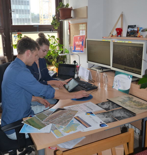
September 2021 marked 16 years since one of the most advanced and robust geographical informational systems in the Czech Republic started taking shape – The GIS of the City of Brno (GISMB).

The GISMB was designed and developed by the GIS Department of the Brno City Municipal Authority. The core of the system was created in 2005, the first web application was launched in 2006. We are very proud that the City of Brno has chosen T-MAPY company to be its partner in creating this great municipal GIS.

2_mini
3

GISMB is based on linking common data with their spatial location within the city limits. This allows users to work even with data that are seemingly non-homogenous and otherwise unlinkable, thus providing a completely new and often unexpected perspective. For example, if we link data describing the age structure of citizens with their place of residence and take into account how this data evolved over time, we can make better plans for school locations or retirement homes.

dana

RNDr. Dana Glosová

GIS Department Manager, Municipal Authority of the City of Brno

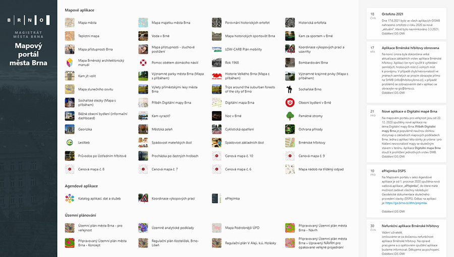
Since 2005, the whole system has undergone multiple changes and after years of continuous development, it now looks completely different than in the beginning. Currently it includes roughly 240 applications, both internal as well as those intended for general public.

GISMB_m

GISMB - one of the most advanced and robust municipal GIS in the Czech Republic

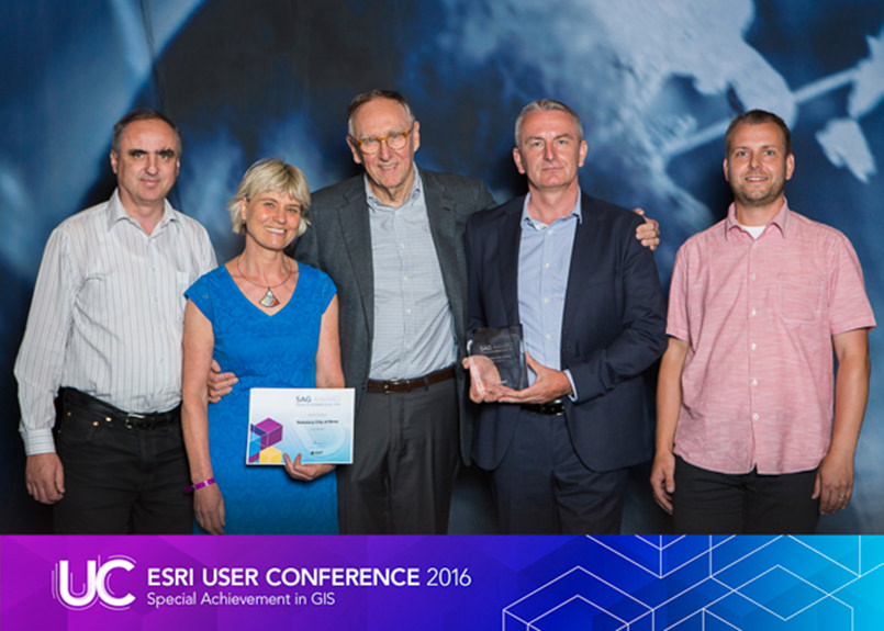
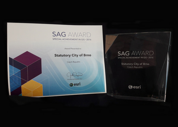
GISMB has been acknowledged abroad as well; in 2009 and 2015, the City of Brno received a prestigious award at the global Esri Conference – the ESRI SAG (Special Achievement in GIS) award.

SAG_img1
SAG_img4_mini

The best value of GISMB is that it is being used on daily basis by hundreds of workers of the municipal and other local authorities, various city organizations, and is gaining more attention within the public as well.

public map applications_m

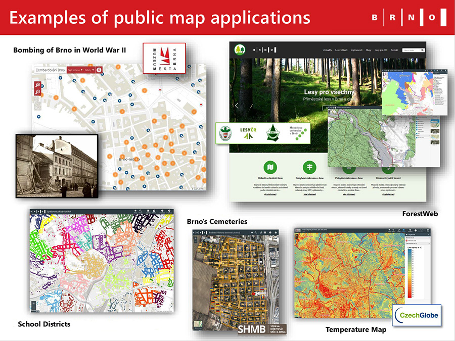
Examples of applications for the general public – from the GISMB presentation (author Dana Glosová)

Which GISMB applications are the most popular? Among the internal apps the most frequently used are those related to the cadastre and land registry, city properties and digital technical maps. Public users are usually interested in applications referring to zoning plans, Brno’s cemeteries and roadwork; applications displaying historical aerial photographs and the map of participatory budget are also popular.

Needless to say, more and more of these applications are approached from tablets and mobile phones.

umbrella_street_lights

Assetino Lighting - more than a list of street lamps and poles

Assetino Lighting is a web-based data management and visualization solution. Its easy-to-use interface and sophisticated tools are designed to help local authorities and other organizations store, manage and display all street lighting-related data (switchboards, poles, cables, cable cabinets, lamps etc.).

The application is used by numerous municipalities in the Czech Republic and Slovakia. In addition to the apparent daily assignments, the office workers use Assetino Lighting to help them with other tasks. Below you can read more about some of them.

Valid data for strategic documents and grants requests

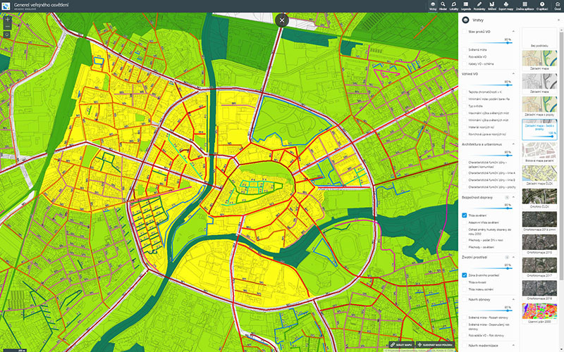
Street lighting is a very important part of every local government agenda. Furthermore, it is technically and financially demanding - strategic planning of this area is therefore crucial. Assetino Lighting provides accurate and up-to-date data for various strategic documents and grant proposals. It also represents a well-suited environment for strategic data display.

pvo_generel_hk_m

The image shows a public map application displaying the Street Lighting Strategic Plan of Hradec Kralove City.

Up-to-date data for city engineering maps

Any municipal government of a larger city should have a detailed engineering map at its disposal. This large scale map displays numerous data layers, therefore bringing it up-to-date is a time-consuming process (which is usually carried out annually). Since Assetino Lighting is used on a daily basis, it represents a great source of relevant information on electric cables, poles, lamps etc.

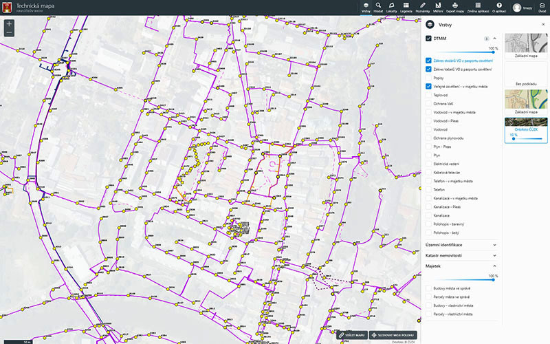
For the city of Havlickuv Brod we set up an automatic interconnection between an Engineering map application and Assetino Lighting. It allows for an effortless comparison of electric cable outlines in these two data sources.

pvo_dtmm_hb_m

Interconnection between Engineering map application and Assetino Lighting provides an instant comparison of electric cable outlines in these two data sources.

Christmas decoration and other objects installed on street light poles inventory

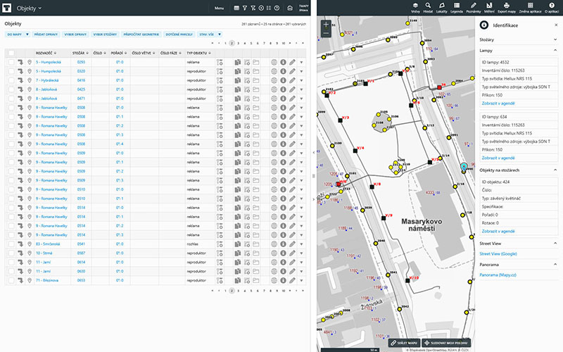
There are many objects attached to or suspended from street lights: loudspeakers, traffic lights, cameras, advertising banners, hanging planters etc. To keep records of such objects Assetino Lighting provides a special module called “object register”. Besides systematized data administration it allows its users to create their own object types. For instance, in Klasterec nad Ohri it is used for Christmas street decoration planning.

pvo_objekty_jihlava_m

Assetino Lighting allows for an easy inventory of various objects: loudspeakers, traffic lights, cameras, advertising banners, hanging planters etc. The image shows how they use the objects register module in Jihlava City.

Smart City ready

For the cities that want to fully employ modern technologies, we offer Smart Assetino Lighting. This special extension interconnects Assetino with various online data transmitters (IoT sensors) attached to street lights. The integration allows Assetino users to visualize and analyze street lighting consumption, temperature of individual lights and other values. It also provides tools for remote control and efficient maintenance of the whole street lighting system. Find out more about our Smart City solutions!

globe_1

Prestigious International Award for Jack Dangermond

Jack Dangermond, Founder and CEO of Environmental Systems Research Institute, Inc. (Esri), received the Planet and Humanity Medal from the International Geographical Union (IGU). This award is only given every four years to people who have made contributions in the political or policy community that have impacted the world in a positive way. Jack Dangermond is the first person in the private sector to receive this prestigious award.

Jack-Dangermond-1m

Esri's founder, Jack Dangermond, was awarded the Planet and Humanity Medal by the International Geographical Union. Jack Dangermond has done more to advance geography and create opportunities for its employment than any individual in history, says IGU in its 2021 Awards Announcement.

Jack Dangermond is a longtime advocate of geography and GIS tools that enable the use of geographic knowledge in many areas of human activity. He says, "Geography helps us to better understand and solve the current problems of the world.” In response to the award, Jack expressed gratitude to all GIS users saying that the IGU was honoring their collective work in advancing GIS over the past decades. “Today, GIS is helping professionals from virtually every field apply geographic science and thinking to their work. This is impacting hundreds of thousands of organizations; helping them understand, make better decisions and in turn contributing to almost every aspect of our modern society. GIS is ultimately making the world a better place.”

We add our congratulations and agree with Jack's words from the bottom of our hearts. At T-Mapy we also believe that geoinformatics helps us to create sophisticated information that can significantly improve our decision-making. This contributes to building and planning more sustainable cities, regions and, in general, improving the environment for all of us. You can find more information about our SmartCity concept on our website.

investice

Map of City Strategic Plans

A public interactive Map of city strategic plans is a smart way to share information on how public money is spent.

Kids putting garbage into plastic containers of different types

Where should waste go? In Prague, three easy-to-use maps will help

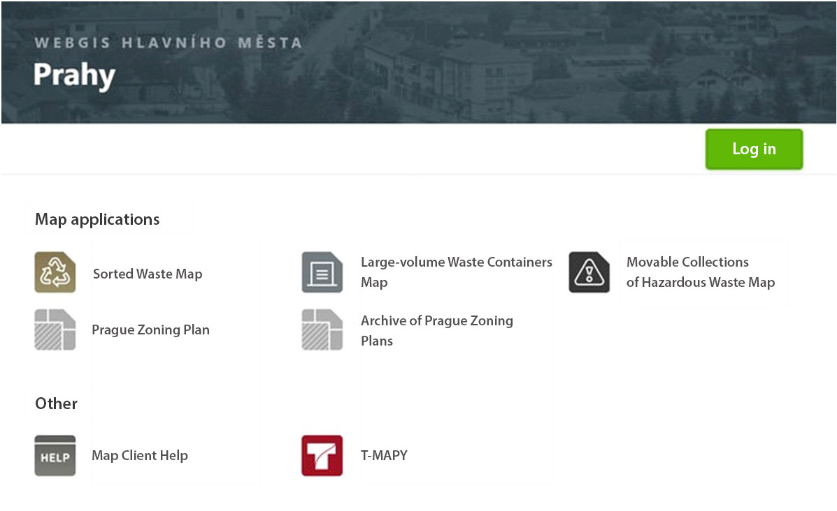
Do you sort waste? In Prague, you can easily find out where and when you can dispose of it. The Municipal Authority of Prague worked together with T-MAPY company on creating three map applications related to waste management.

On these interactive maps based on the Assetino platform, citizens of Prague can easily find locations of the nearest recycling bins, where and when large dumpsters will be placed, and where to dispose of hazardous waste.

All three map applications are accessible via the Municipal Authority’s map portal. Individual city districts have these apps at their disposal to be published on their own web pages. Other waste management related maps will be created in the future.

obr-aj2

Recycling Bins Map

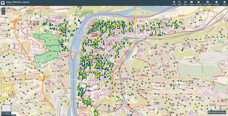
The Recycling Bins Map contains information about all sorted waste containers within the boundaries of the capital city of Prague (this service is provided to citizens of Prague for free as a part of the Complex system for handling municipal waste). The map covers over 5,400 locations.

Each location is colour-coded in order to indicate which type of waste may be disposed of there. After clicking on the selected location, detailed information is displayed – how often containers are collected, type of container, and whether it is accessible to the public. The application includes both public waste containers as well as non-public containers which serve residents of a specific building exclusively.

mapa2_mini

Large-volume Waste Containers Map

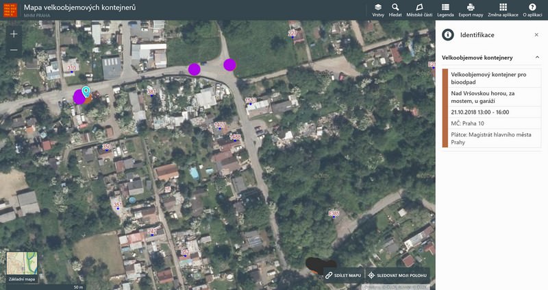
Residents of Prague have an option to dispose of large-volume waste at collection yards, or in large-volume waste containers (LWC) which are placed directly on city streets. Biohazardous waste containers are also installed in the city streets at Prague’s residents disposal.

Thanks to the interactive map of LWC, Prague’s citizens can easily find out where and when these containers will be available to them. After clicking on a particular map symbol, an information panel will pop up with a description of container type (mixed waste/biowaste) as well as dates&times during which the container will be accessible.

As the application includes over 7,000 items, a special map layer was created to simplify navigation in such large amounts of data. It shows locations where containers will be placed in the upcoming seven days.

VKO_mini

Map of Movable Collections of Hazardous Waste

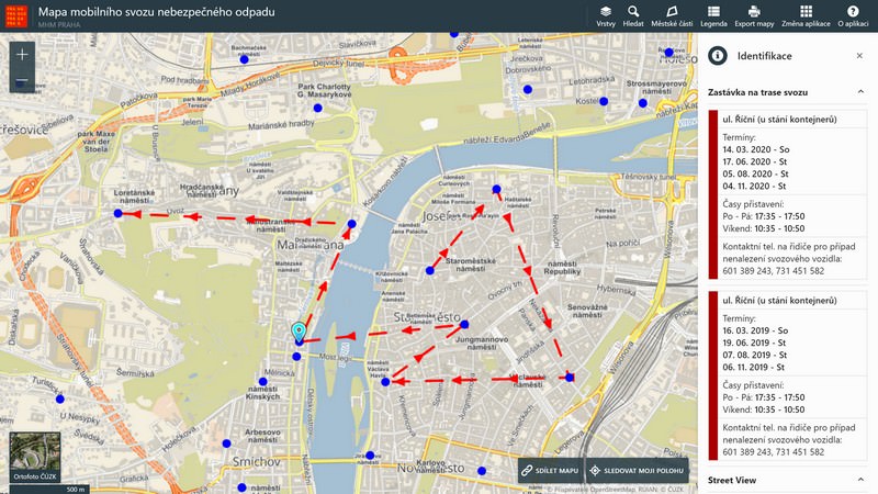
In this interactive map, users can look up routes of hazardous waste collection vehicles so that they know when one is taking place in their area (there are over 300 movable hazardous waste collections in Prague every year). The map displays individual collection routes and the stops on each route. After clicking on a particular route, collection dates and time will be displayed. Contact information for the collection vehicle driver is also included.

Depending on selected map layers, users can display either all collection routes within the boundaries of the city of Prague or the routes where the movable waste collection will take place in the upcoming 30 days.

msno_mini

Technical Solution

Contracting authority

Municipal authority of the City of Prague

Contracted provider

T-MAPY ltd.

User

The public

Main requirements

Well-organized visualization, ease of navigation, compatibility with existing municipal authority’s systems.

The goal of the contract was to create a series of monothematic map applications for informing the public about specific topics in the area of waste management. Since the data is acquired from various sources, prior to visualization the data model had to be unified. A system for periodic and automatic data update was set up as well.

The system framework for the applications is delivered by I-MEDIA company – it facilitates internal management of the system which is also linked with waste collection financing. The Assetino Waste Management application from T-MAPY company provides tools for data publishing in well-organized maps, including search and filtering mechanisms and geometric data editing tools. A map layer is created for each topic which allows users to toggle the selected topic on/off.

The interface of public map applications is designed with regard to maximum clarity and intuitiveness. All map applications allow users to work with map layers (toggling selected topics on/off), search by address, or change of the background map (basic map/aerial image).

Reference

Within the past few years, we have collaborated with T-MAPY company on many successful projects. Therefore, when it came to this contract – a set of map applications for Prague’s waste management - I could rely on T-MAPY to provide problem-free cooperation, professionalism, and a top-quality outcome.

Our goal was to provide Prague’s residents with comprehensible information on waste management, and thanks to T-MAPY, this was achieved with an excellent result. Three map applications were created during the first phase of the project: Sorted Waste Map, Large-volume Container Map, and a Map of Mobile Collections of Hazardous Waste. The applications have a very attractive design, are well-organized and easy to navigate. That’s very important since they are intended for the general public. At the same time, it is a modern and technically advanced solution which makes daily tasks easier for us, the system administrators.

The great set-up cooperation with T-MAPY continues – currently, we are collaborating with them on other map applications which will address the internal needs of the municipal office.

Nora_Lebrova

Nora Lebrova

The administrator for Information Systems, Prague Municipal Authority
stainless factory chimneys

Facility Management and GeoFaM - from data to processes

Usually, during our work as well as leisure activities, we try to achieve the appropriate (optimal) goal or result, whether it’s a professional or sports performance, free time, or any other type of activity. We typically reach the optimum goal if we manage to harmonize activities and functions with the people who are involved in them and the environment in which we carry them out.

Facility management is, in a way, a method for synchronizing work environment, employees, and work activities within an organization. GeoFaM is then a platform which utilizes the principles of GIS for use in facility management. The basic pillar of GeoFaM is the data describing the domain or area in which we utilize the methods and principles of facility management.

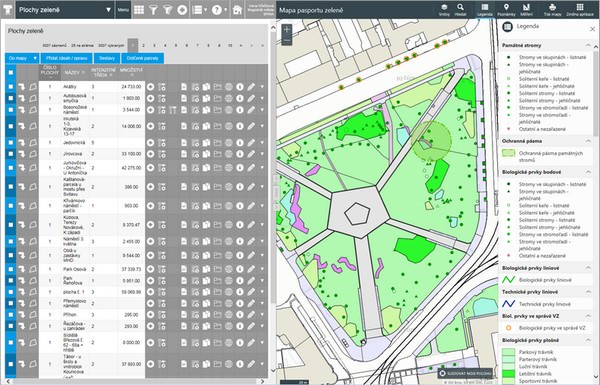
zelene_plochy_min

For example, in order to operate and maintain buildings and their technologies, we will, of course, need to have the information about the building in terms of construction documentation as well as technological documentation. This data will be used to optimize processes in the building by synchronizing the building environment, functions performed inside it, and, most importantly, the users of the building and their needs.

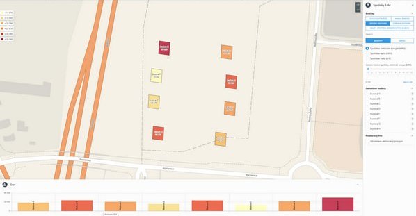
budovy_min

We are newly starting to expand the data warehouse by adding support for processes related to building operations or landscape management. We need operational data for this – one, they provide us with information about planning, performing, and evaluating maintenance and operational processes, but at the same time, they are used for evaluating and consequently optimizing these processes.

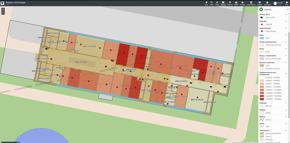
Budovy_a_technologie

The combinations of data of as-built model of buildings and operational data obtained via “smart” IoT devices are opening up vast possibilities in modern facility management, as well as in the administration of various kinds of properties (asset management). We are ready for this trend and can’t wait for what it brings!

Copyright © 2024 | T-MAPY spol. s r.o.