1

Project Get It Sorted Successfully Delivered

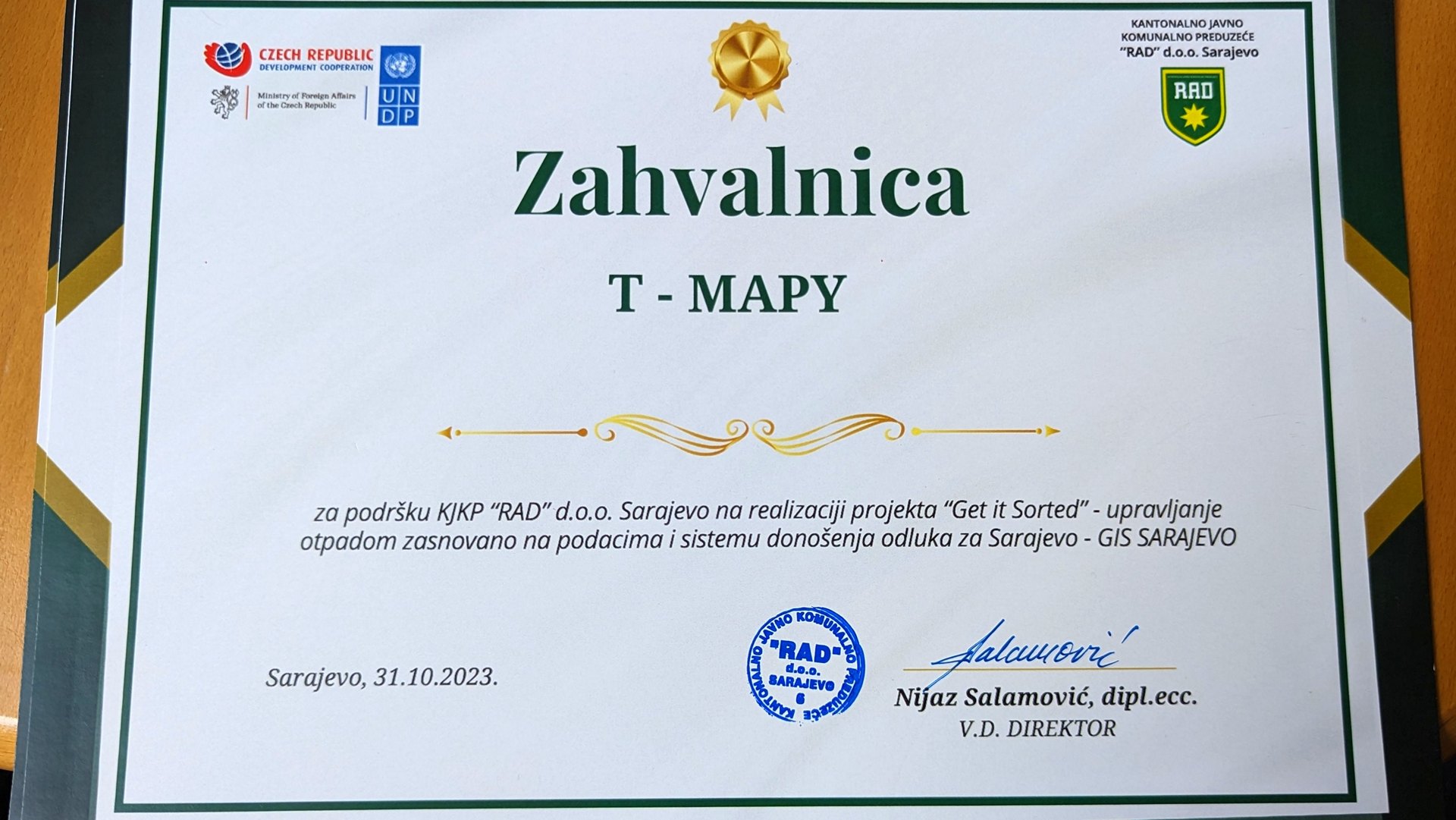
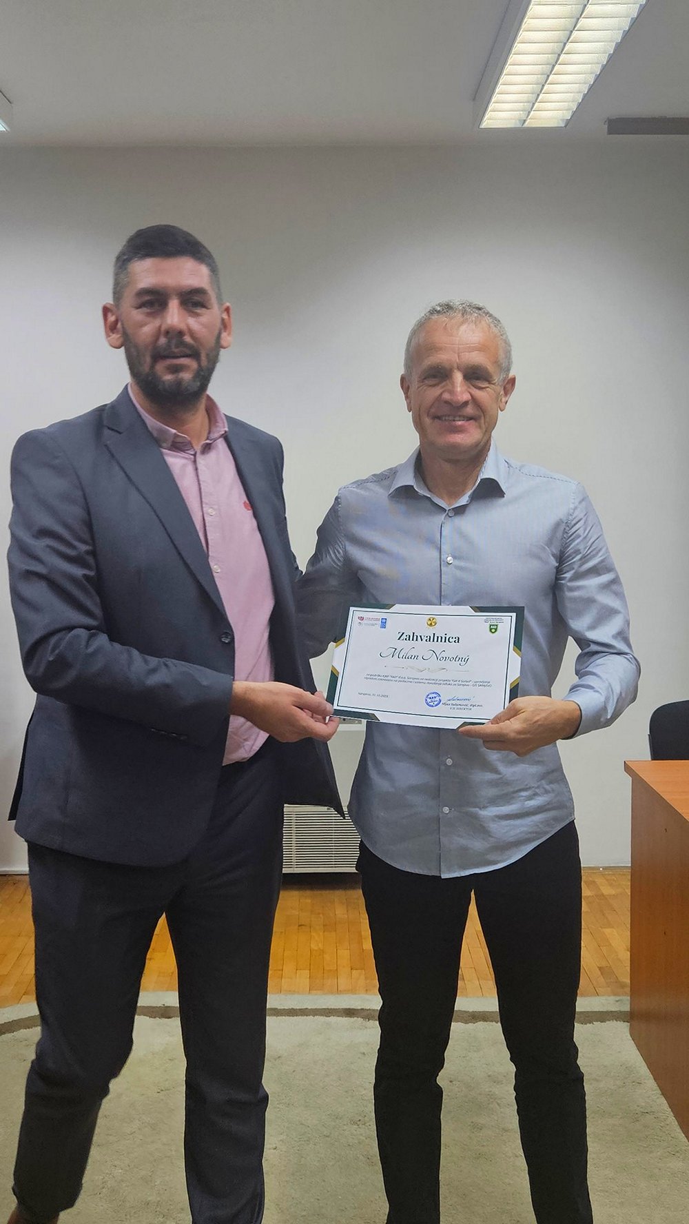
On the occasion of the final phase of the project "Get It Sorted - data-based waste management and decision- making system for Sarajevo (GIS Sarajevo)", all the results of the project were officially handed over to KJKP RAD, as the final beneficiary of the project.

Sarajevo1

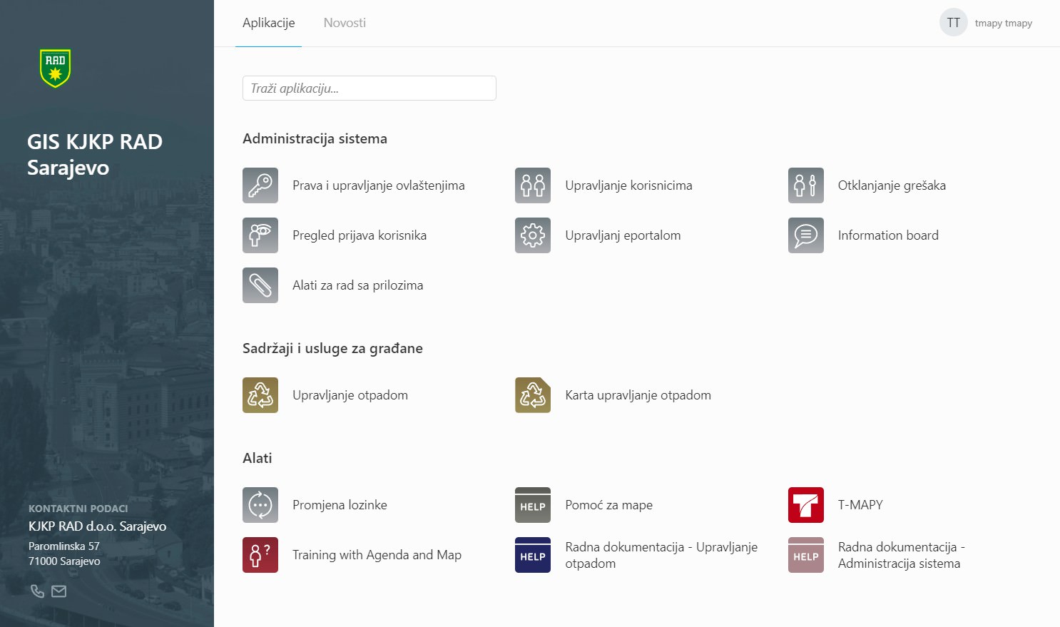
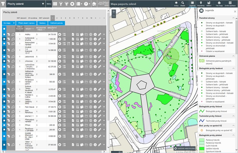
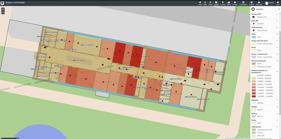
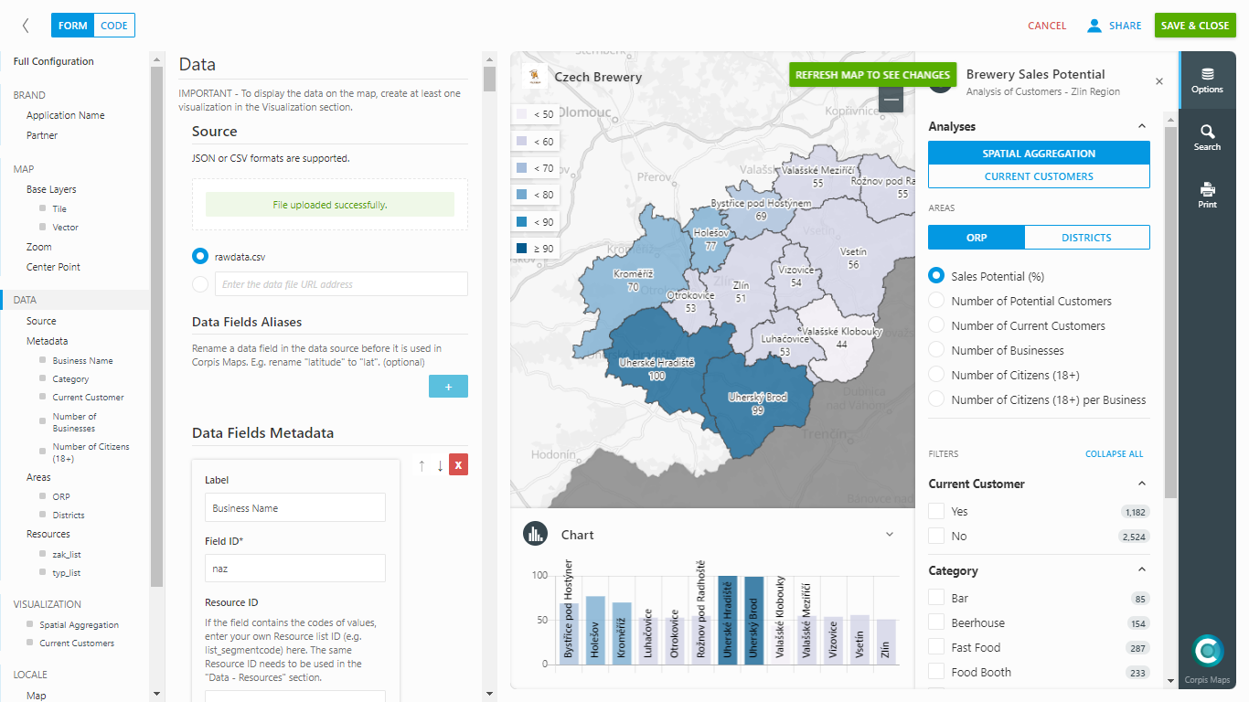
The main goal of the GIS Sarajevo project is to develop a modern solution for managing resources and assets (Asset management) based on the Geographical Information System (GIS) for KJKP RAD. This initiative aims to improve capabilities in smart management solutions, maintaining records of assets and other resources, and providing decision support based on up-to-date data and future development for all participants in the waste management system in Sarajevo Canton.

Sarajevo2

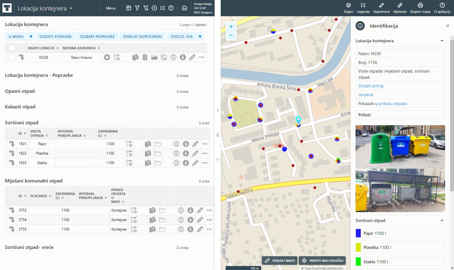
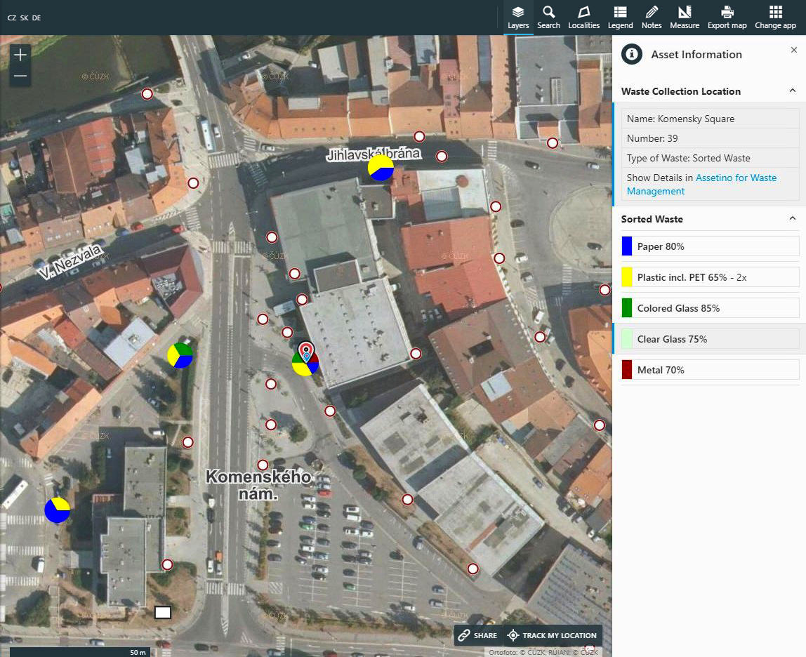
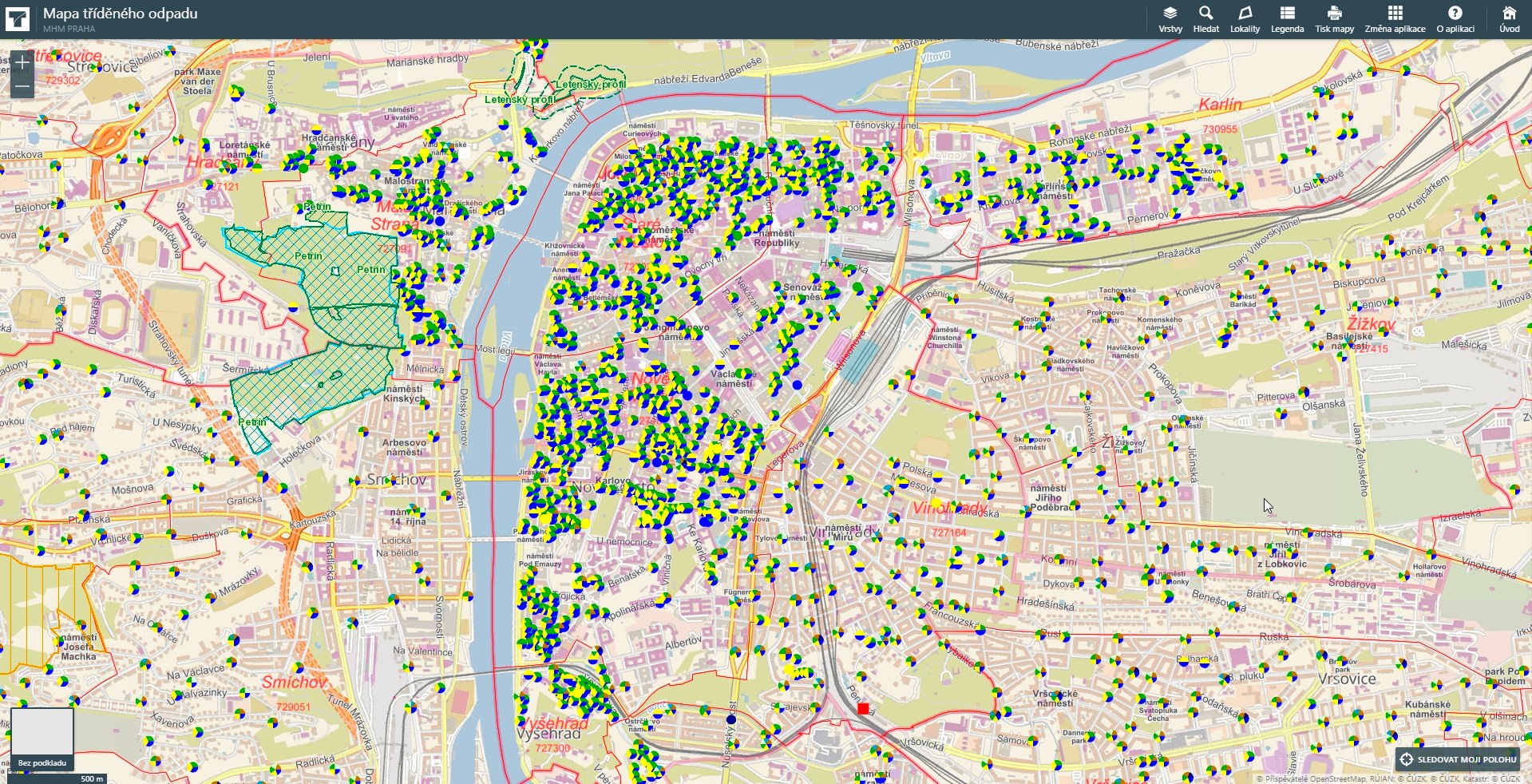
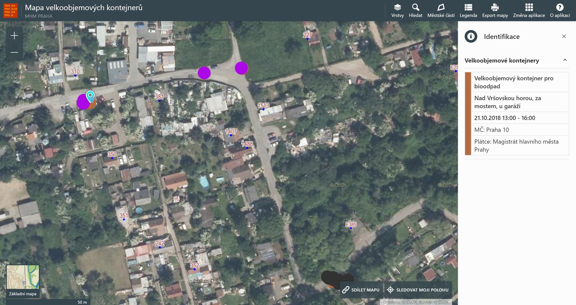
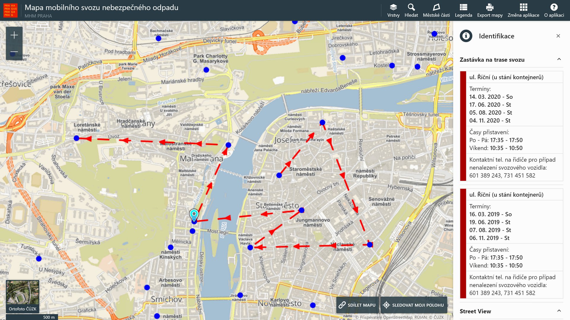
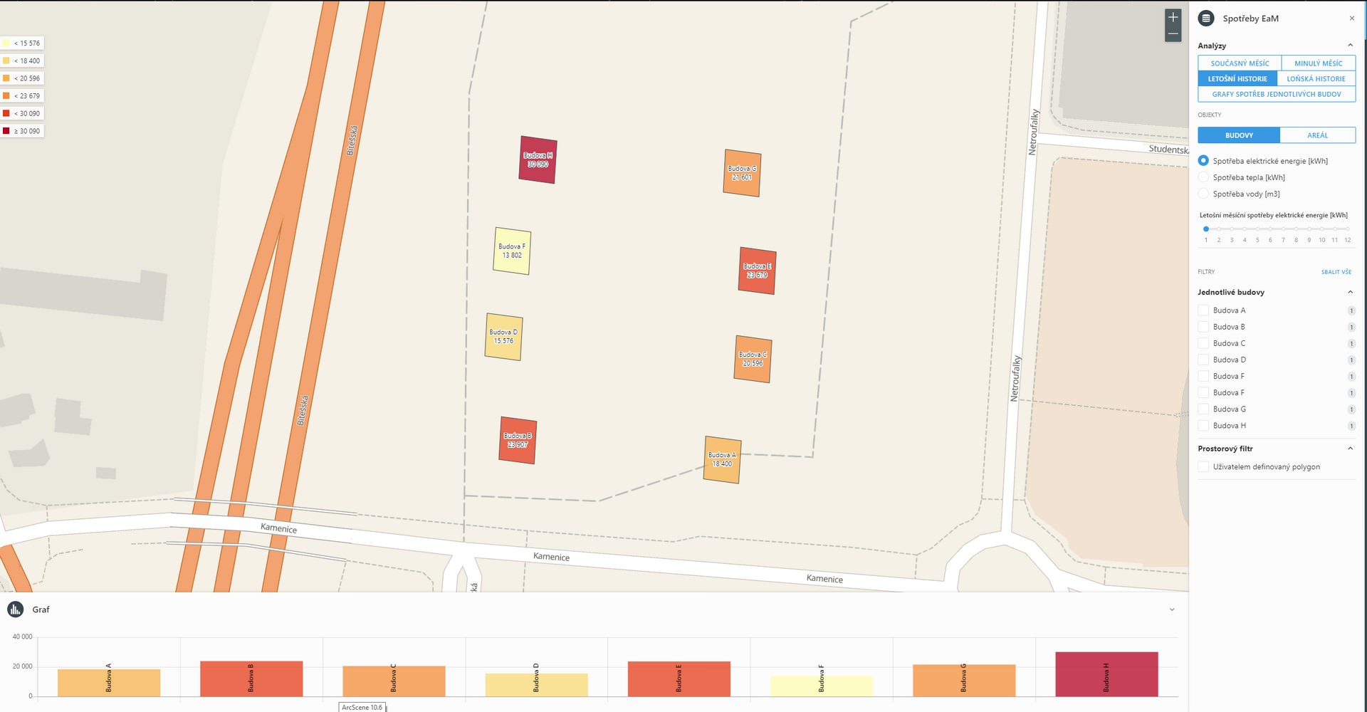
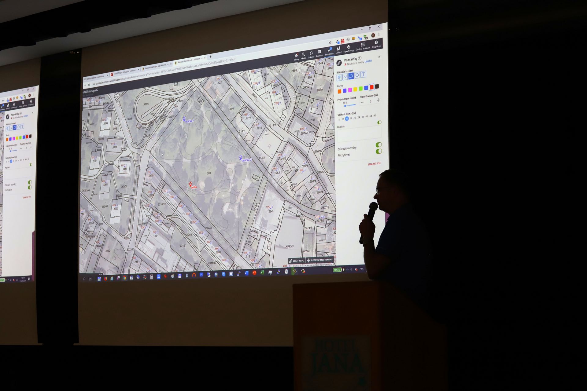
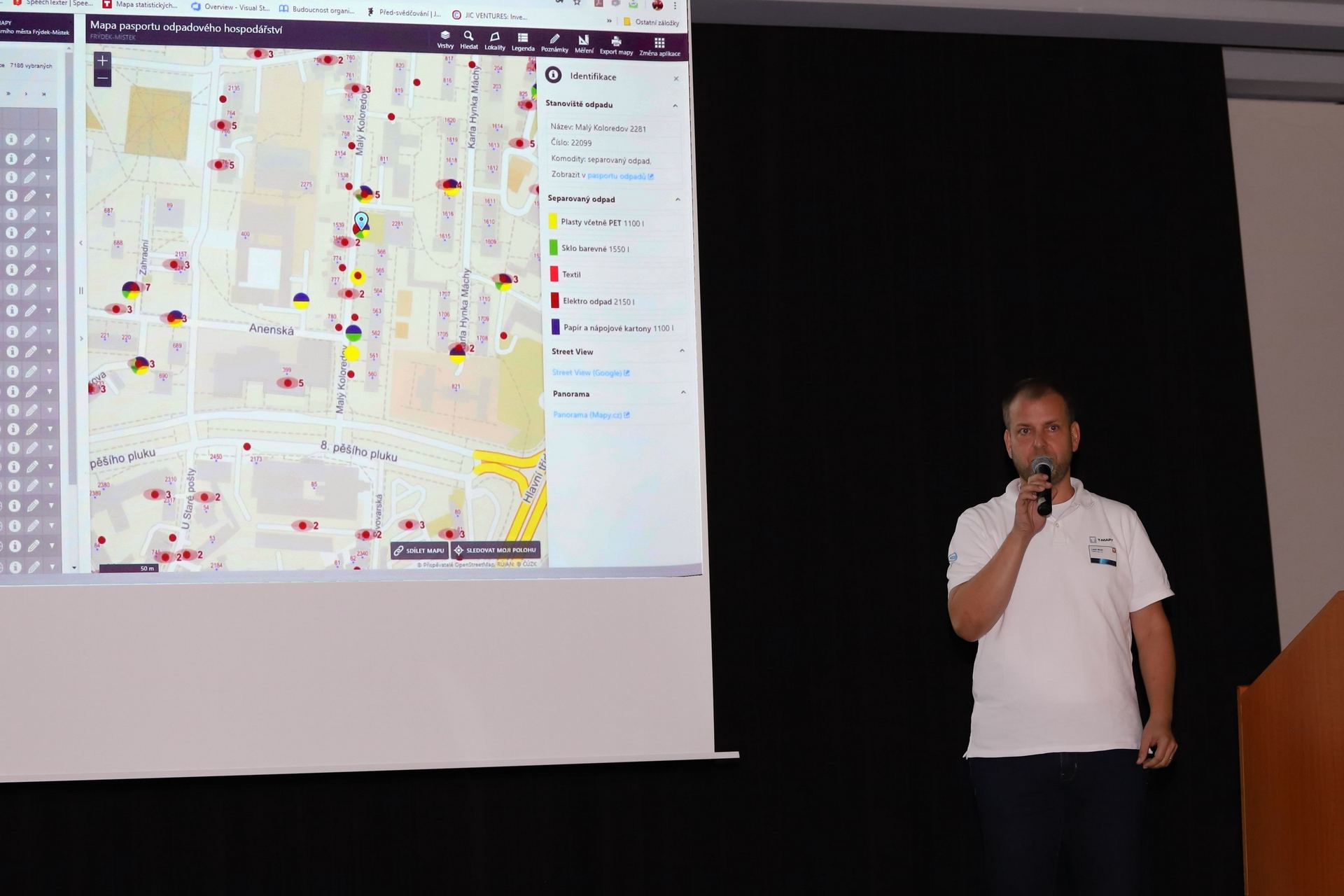
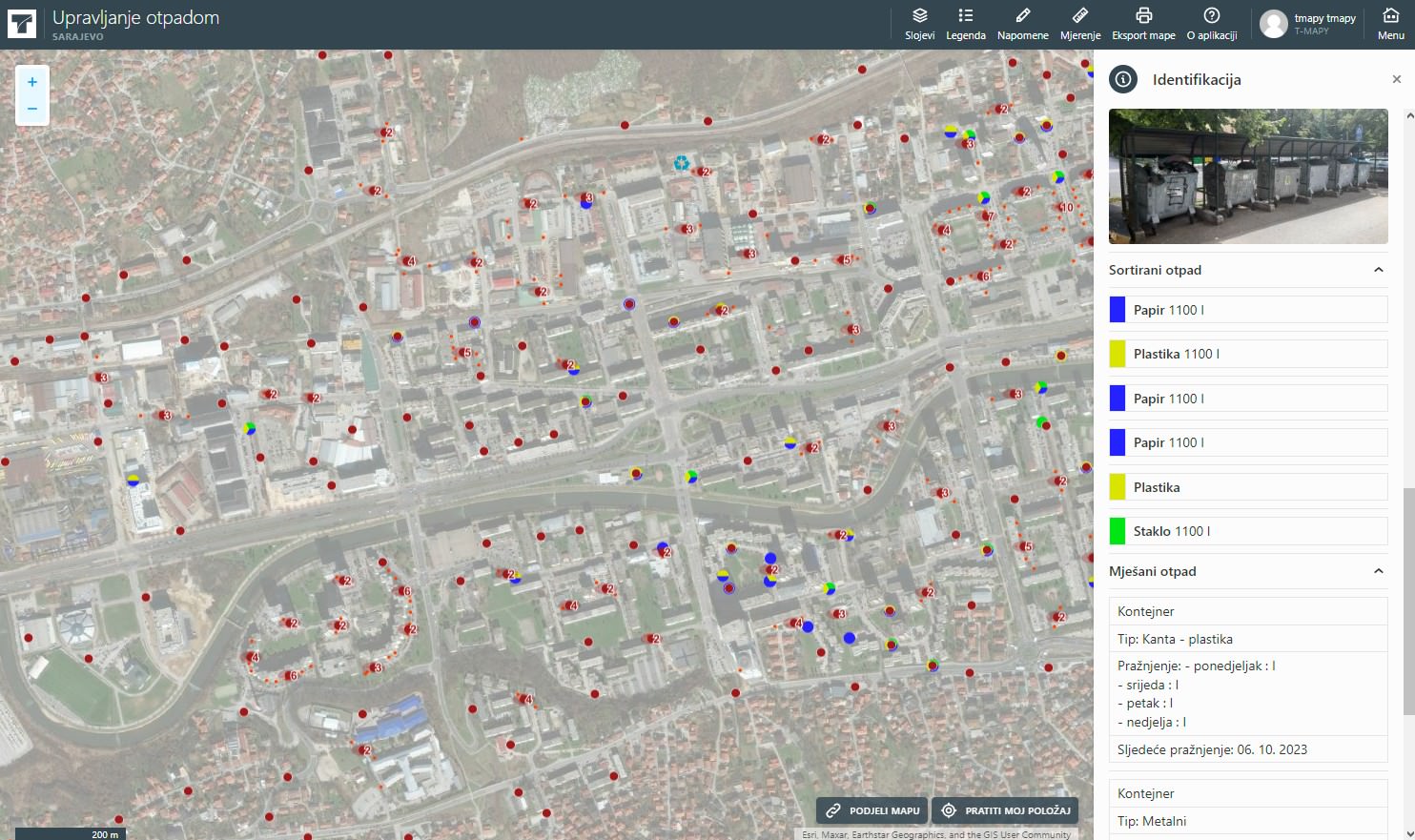
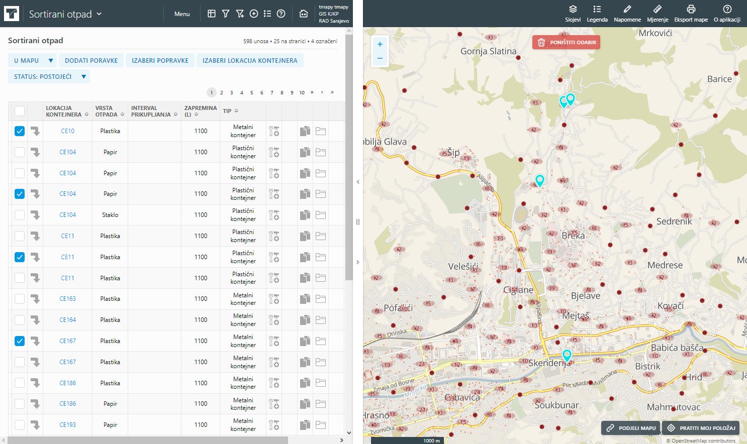
Within the system, there is also a section intended for the public, which at the current stage contains an overview map of green islands, locations of containers for mixed waste and recycling yards with information on collection times, types of waste and other useful data. This part of the system also allows the public to be informed about the periodic installation of bulk waste containers or emergency measures and temporary restrictions.

sarajevo3

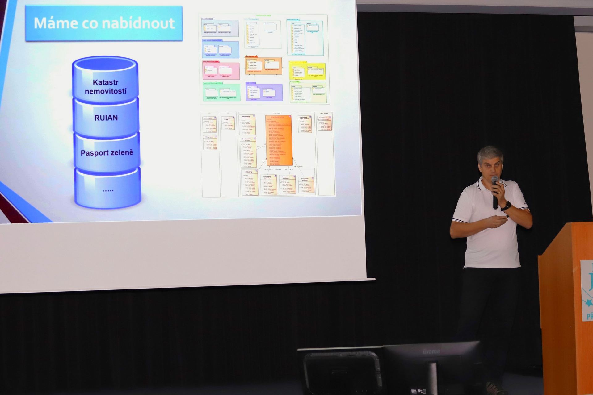
Work on the system lasted throughout 2023 and represents a significant step forward, because in addition to new opportunities for quality management of resources and services and significant simplification of the work of certain services, it lays the foundations for further development of the waste management system within the KJKP RAD, future integration of GPS solutions , automatic reading of the degree of container filling, process automation and other smart solutions. The system was created on an open source basis and enables the integration and exchange of data with other services of the Canton of Sarajevo for the purpose of implementing complex smart city solutions (Smart City).

sarajevo4

The project was implemented within the framework of the Czech-UNDP partnership for sustainable development goals (SDGs) and the contractor is the Czech company T-MAPY. Financial support for this initiative was generously provided by the Ministry of Foreign Affairs of the Czech Republic. The main goal of the CUP program is to use Czech know-how and innovative solutions to support the Sustainable Development Goals (SDGs) in partner countries. The total budget of the project was 70,000 USD, while the financial support of the CUP program was 39,900 USD.

loga

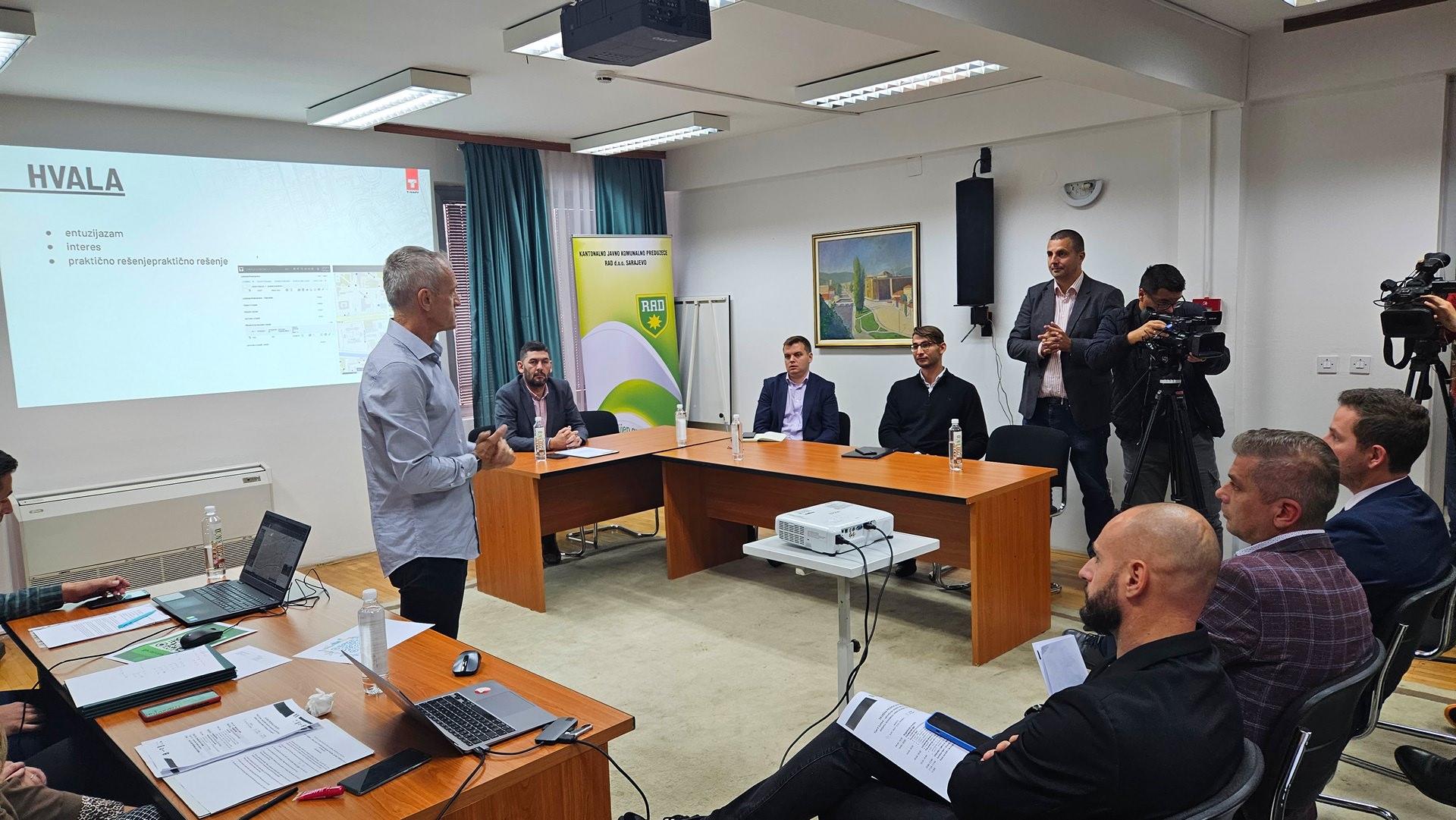
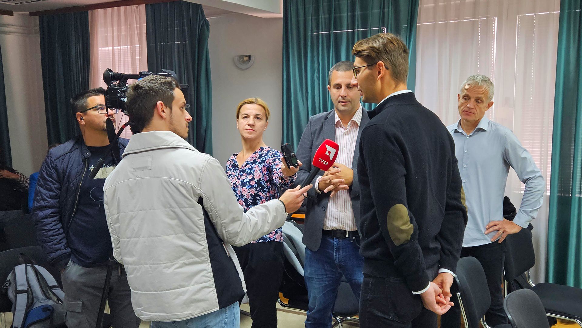
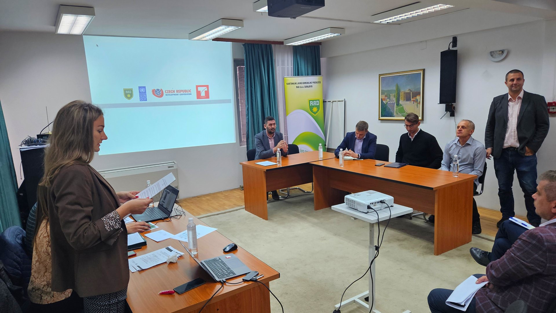
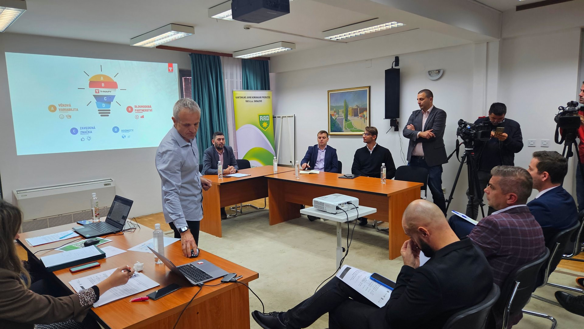
The formal presentation of the project results, including a detailed presentation of solutions, project results and future plans, was held on Tuesday, October 31, 2023. Key representatives of Sarajevo Canton, UNDP, Embassy of the Czech Republic in Sarajevo, KJKP RAD and T-MAPY participated in this event.

1
2
3
4
5
zahvalnica
6
7

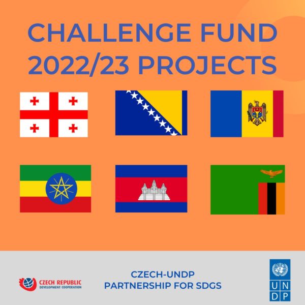
The project was financed by the Challenge Fund: Czech Solutions for SDGs, an effective driver of innovation and change in the region.

osn

T-MAPY engages in Challenge Fund Project in Bosnia and Herzegovina

Challenge Fund is an activity of Czech-UNDP Partnership for Sustainable Development Goals (SDGs). Its main objective is to bring Czech expertise and innovative solutions for SDGs to partner countries.

new-CF-projects-e1671444168682

Challenge Fund Projects 2022/23

sdgs

Sustainable development goals

Last year, the Challenge Fund received a record number (69) of applications. T-MAPY was among twelve innovators selected to carry out their submitted proposals. Within our project we will provide a data-driven smart waste management system for the Canton of Sarajevo, Bosnia and Herzegovina.

The system can also serve as a foundation for other smart city management solutions in the country.

waste3

T-MAPY Waste Management

The Czech-UNDP Partnership is based on the idea that many countries are facing challenges similar to those the Czech Republic had gone through in the past decades. Having been established in 1992, T-MAPY has come a long way to become one of the key players on the geomatics market in the Czech Republic and Slovakia. I love the idea that via the Challenge Fund we can share the know-how we have gathered throughout the years, and thus help initiate sustainable development processes in other countries.

MINO_min

Milan Novotny

CEO, T-MAPY
image-2

The project is implemented by the United Nations Development Programme (UNDP) through the Challenge Fund, with the financial support of the Ministry of Foreign Affairs of the Czech Republic.

T-MAPY_carousell_30let_1920x800_smaller

We are celebrating 30 years!

It’s been 30 years since T-MAPY was established. On May 20, 1992, we brought the first computer (a Compaq with a 386 processor and 40 MB hard drive) to our company office and with it, an A1-size digitizer. We started the digitization process “from scratch” - by geographic data production.

During the second half of the 1990’s, we focused on the creation of GIS applications - first for desktop, and once the internet boom started, very quickly for the web as well. These two pillars – quality data production and development of our own application software - built the foundations for our company’s subsequent growth.

In the following years, we increased the number of our customers and employees, and broadened the portfolio of products and services. Most importantly, we grew and deepened our expert knowledge and experience. In recent years, the company growth also included acquisitions and strategic partnerships with major players on the market.

Today, T-MAPY is one of the biggest geomatic companies in both Czechia and Slovakia. We’ve taken part in the largest national projects in our area of expertise. Thousands of people work with our software on daily basis. Our solutions are used at all levels of public administration, in various emergency and rescue service organizations, as well as in private companies.

Our long-term goal is to support and enhance processes in both the public and private sector by providing top tier geomatic tools. We help our customers work better with spatial information. But we also provide them with tools for integrating this information with other data so that they can fully utilize their spatial data potential. We achieve all this by using cutting-edge technologies, both in the sphere of software product creation and (as well as) geodata production.

Jiří_Bradáč

Jiri Bradac

Executive director, T-MAPY

I believe that infrastructure built on relevant data and newest technologies helps enhance the quality of life of the entire society. It contributes to the construction of more sustainable cities and regions, and generally improves people’s lives on the entire planet. For 30 years now, T-MAPY has made it possible for its customers to gather, analyze and generate information that support quality decision-making and increase the effectiveness of services provided. We were able to achieve this due to the support of our customers, partners, and employees. I thank you all, and I look forward to further cooperation in the upcoming years.

MINO_min

Milan Novotny

Executive director, T-MAPY
fúze_hero

Further growth of T-MAPY in 2021

In 2021 T-MAPY confirmed its strong position as GIS leader in the Czech Republic and Slovakia by two significant acquisitions. It became a major shareholder of GRID and MAPA Slovakia Digital.

GRID is a Prague-based geodetic survey company. It is one of top Czech specialists in engineering surveying and mobile mapping. "Combining the know-how of these two companies will bolster our expertise in the field of digital technical maps, 3D GIS, building information modelling (BIM) as well as Automated Mapping/Facilities Management (AM/FM)”, says Jiri Bradac, CEO of T-MAPY and the new Executive Director of GRID.

T-MAPY expanded its activities to Slovakia in 2014. The growing number of local customers resulted in establishment of an independent company, T-MAPY Slovensko. In 2021 MAPA Slovakia Digital was merged with T-MAPY Slovensko, becoming T-MAPY.

Jan Gasparek, Executive Director of T‑MAPY s. r. o., points out: “We welcome this union and believe that together we will be stronger in business operations. T‑MAPY will now be able to take advantage of a wide range of synergies, bring unique products to the market, and further increase the quality of services we provide.”

Kids putting garbage into plastic containers of different types

Where should waste go? In Prague, three easy-to-use maps will help

Do you sort waste? In Prague, you can easily find out where and when you can dispose of it. The Municipal Authority of Prague worked together with T-MAPY company on creating three map applications related to waste management.

On these interactive maps based on the Assetino platform, citizens of Prague can easily find locations of the nearest recycling bins, where and when large dumpsters will be placed, and where to dispose of hazardous waste.

All three map applications are accessible via the Municipal Authority’s map portal. Individual city districts have these apps at their disposal to be published on their own web pages. Other waste management related maps will be created in the future.

obr-aj2

Recycling Bins Map

The Recycling Bins Map contains information about all sorted waste containers within the boundaries of the capital city of Prague (this service is provided to citizens of Prague for free as a part of the Complex system for handling municipal waste). The map covers over 5,400 locations.

Each location is colour-coded in order to indicate which type of waste may be disposed of there. After clicking on the selected location, detailed information is displayed – how often containers are collected, type of container, and whether it is accessible to the public. The application includes both public waste containers as well as non-public containers which serve residents of a specific building exclusively.

mapa2_mini

Large-volume Waste Containers Map

Residents of Prague have an option to dispose of large-volume waste at collection yards, or in large-volume waste containers (LWC) which are placed directly on city streets. Biohazardous waste containers are also installed in the city streets at Prague’s residents disposal.

Thanks to the interactive map of LWC, Prague’s citizens can easily find out where and when these containers will be available to them. After clicking on a particular map symbol, an information panel will pop up with a description of container type (mixed waste/biowaste) as well as dates&times during which the container will be accessible.

As the application includes over 7,000 items, a special map layer was created to simplify navigation in such large amounts of data. It shows locations where containers will be placed in the upcoming seven days.

VKO_mini

Map of Movable Collections of Hazardous Waste

In this interactive map, users can look up routes of hazardous waste collection vehicles so that they know when one is taking place in their area (there are over 300 movable hazardous waste collections in Prague every year). The map displays individual collection routes and the stops on each route. After clicking on a particular route, collection dates and time will be displayed. Contact information for the collection vehicle driver is also included.

Depending on selected map layers, users can display either all collection routes within the boundaries of the city of Prague or the routes where the movable waste collection will take place in the upcoming 30 days.

msno_mini

Technical Solution

Contracting authority

Municipal authority of the City of Prague

Contracted provider

T-MAPY ltd.

User

The public

Main requirements

Well-organized visualization, ease of navigation, compatibility with existing municipal authority’s systems.

The goal of the contract was to create a series of monothematic map applications for informing the public about specific topics in the area of waste management. Since the data is acquired from various sources, prior to visualization the data model had to be unified. A system for periodic and automatic data update was set up as well.

The system framework for the applications is delivered by I-MEDIA company – it facilitates internal management of the system which is also linked with waste collection financing. The Assetino Waste Management application from T-MAPY company provides tools for data publishing in well-organized maps, including search and filtering mechanisms and geometric data editing tools. A map layer is created for each topic which allows users to toggle the selected topic on/off.

The interface of public map applications is designed with regard to maximum clarity and intuitiveness. All map applications allow users to work with map layers (toggling selected topics on/off), search by address, or change of the background map (basic map/aerial image).

Reference

Within the past few years, we have collaborated with T-MAPY company on many successful projects. Therefore, when it came to this contract – a set of map applications for Prague’s waste management - I could rely on T-MAPY to provide problem-free cooperation, professionalism, and a top-quality outcome.

Our goal was to provide Prague’s residents with comprehensible information on waste management, and thanks to T-MAPY, this was achieved with an excellent result. Three map applications were created during the first phase of the project: Sorted Waste Map, Large-volume Container Map, and a Map of Mobile Collections of Hazardous Waste. The applications have a very attractive design, are well-organized and easy to navigate. That’s very important since they are intended for the general public. At the same time, it is a modern and technically advanced solution which makes daily tasks easier for us, the system administrators.

The great set-up cooperation with T-MAPY continues – currently, we are collaborating with them on other map applications which will address the internal needs of the municipal office.

Nora_Lebrova

Nora Lebrova

The administrator for Information Systems, Prague Municipal Authority
stainless factory chimneys

Facility Management and GeoFaM - from data to processes

Usually, during our work as well as leisure activities, we try to achieve the appropriate (optimal) goal or result, whether it’s a professional or sports performance, free time, or any other type of activity. We typically reach the optimum goal if we manage to harmonize activities and functions with the people who are involved in them and the environment in which we carry them out.

Facility management is, in a way, a method for synchronizing work environment, employees, and work activities within an organization. GeoFaM is then a platform which utilizes the principles of GIS for use in facility management. The basic pillar of GeoFaM is the data describing the domain or area in which we utilize the methods and principles of facility management.

zelene_plochy_min

For example, in order to operate and maintain buildings and their technologies, we will, of course, need to have the information about the building in terms of construction documentation as well as technological documentation. This data will be used to optimize processes in the building by synchronizing the building environment, functions performed inside it, and, most importantly, the users of the building and their needs.

budovy_min

We are newly starting to expand the data warehouse by adding support for processes related to building operations or landscape management. We need operational data for this – one, they provide us with information about planning, performing, and evaluating maintenance and operational processes, but at the same time, they are used for evaluating and consequently optimizing these processes.

Budovy_a_technologie

The combinations of data of as-built model of buildings and operational data obtained via “smart” IoT devices are opening up vast possibilities in modern facility management, as well as in the administration of various kinds of properties (asset management). We are ready for this trend and can’t wait for what it brings!

mam

T-MAPY takes part in the development of GIS in Moldova

T-MAPY, together with the GEOtest company, is working on a project which supports the implementation of a regional strategy by using GIS data in Moldova. The entire project has shifted into its second half both time-wise and process-wise, and we are happy to share the results it has achieved so far.

czech rep development_mini

The first trip we undertook was in the fall of 2018. Since then, we have visited Chisinau and its surrounding regions several times. We were able to analyze the situation in SDI (Spatial Data Infrastructure) by conducting a complex survey.

We addressed 90 institutions in total; these included all ministries as well as most government organizations, scientific institutions, universities, and non-government organizations. Our goal was to evaluate the current expertise and technical background as well as identify existing geodata in Moldova. We found that basic geodata was of excellent technical quality, yet if updates are not ensured, the data cannot be used as a reference for follow-up thematic data. Currently, the pillar grasped in the most complex way from conceptual, legislative, as well as the implementation point of view includes metadata, the geoportal, and network services.

v HK_mini
random_mini

On the other hand, the competence and development of human resources represent one of the weakest aspects of the current situation. The high fluctuation of qualified workers, their insufficient numbers in public administration, and a lack of a lifelong education system paralyze many activities, including the integration of the geoportal and the open data portal. Regarding thematic data, we evaluated its condition, type of distribution, and compliance with standards, and we conducted an assessment of needs and of interest in missing spatial information.

We fused all of this information together into a demonstration of a simple map application and into our EDAS metainformation system.

random2_mini
IPR_mini

Another integral part of this project was conducting numerous GIS training sessions, under the wings of the GEOtest company. These continue to take place at regional agencies, the land cadaster agency, and the Ministry of agriculture, environment, and regional development. The training sessions culminated in a professional tour around the Czech Republic. In total, 42 Moldovan visitors travelled to Brno, Hradec Králové, and Prague. The institutions they visited included the Masaryk University, the Municipal Authority of Brno, the Municipal Authority of Hradec Králové, the Institute for Planning and Development of Prague, the Czech Information Agency for the Environment, and finally a visit to the Czech Development Agency.

ŽP_mini

The key outputs of the project include an analysis of legislative documents, methodologies, and binding documents. While analyzing the current state of the national spatial data infrastructure of Moldova, a total of six legal bottlenecks were discovered. The goal of the proposed legislative measures is to contribute to an increased quality of Moldovan legislation in the spatial data area. At the same time, the proposals for legislation revisions/amendments represent inputs for emerging Moldovan national strategy on spatial information.

Corpis Maps Portal Hero

Introducing New Corpis Maps Portal and Corpis Maps Studio!

New version of Corpis Maps has been released.

“In last months, we have been working hard on the most important innovation in the history of the Corpis Maps product. Our goal was to create a single place which will enable simple creation of analytical maps and comfortable sharing in an organization or with the public. The result is the all-new Corpis Maps Portal and Corpis Maps Studio, that will help you to utilize maximum from the power of analytical maps in the private and public sector.”

japo_xicht

Jaroslav Polacek

Corpis Maps Product and Partnership Manager

Map and User Management in Corpis Maps Portal

In Corpis Maps Portal, you can create analytical maps and usersof two types (Administrator, Viewer), each type has specific rights. An “Administrator” has the right to create and edit analytical maps and users. A “Viewer” has the right to view maps that are assigned to him/her.

users

New Corpis Maps Studio

Corpis Maps Portal contains the new Corpis Maps Studio (formerly known as Creator), where you can simply create and share your analytical map without the need to know any programming language. All important features are immediately accessible together with the live preview of the map you are just creating.

Studio

Drag and Drop Data Upload

When creating a map, you can now upload data (CSV or JSON format) directly by selecting a file from your computer or drag the file to the drop zone. It is so easy! If you prefer to read the data from a URL address, it is available too.

drag_and_drop

Ready to Use Aggregation Polygons and GeoEnrichment Data

From now, you will never need to think about how how to create aggregation polygons (districts, regions, etc.) for your country, we did it for you. Simply choose the right one from the list. Use the same way to enhance your map wit statistical data in the GeoEnrichment section. Number and areas of these datasets will be growing based on your ideas and needs.

GeoEnrichment

Map Sharing

Every map in Corpis Maps Portal can be shared across your organization or with the public (including iframe). When configuring a map, click the “Share” button and select, who will have access to the map.

Map Sharing

More information about Corpis Maps Portal and Corpis Maps Studio

All features of new Corpis Maps Portal will be described in detail on our Blog.

Availability

All Corpis Maps Integration Partners, Solution Partners and clients have immediate access to this new version..

Are you interested in a Corpis Maps demo map containing your own data?

Would you like to integrate Corpis Maps into your product (CRM, ERP, E-commerce, …)?

hero

T-MAPY User Conference Attracts Record Numbers of Asset Management Professionals

Nearly 160 asset management professionals, representing more than 60 organizations, came together in Prerov, Czech Republic to discuss industry trends such as data driven decision making, SMART Cities and IoT integration. Meeting at the T-MAPY annual user conference, delegates from government organizations mixed with retail, public transport and emergency services professionals to discover the latest developments in geoinformatics and were presented with updates on the award-winning Assetino Asset Management software.

Image00001
Image00004

Delegates at the two day event had a choice of around forty sessions to attend with options including Assetino demonstrations, customer experience presentations and an overview of T-MAPY’s activities in its role as the leading architect of digital technical mapping in the Czech Republic.

Image00002
Image00006
Image00005
Image00008

Assetino presentations included new module demonstrations; Waste, Cemeteries, Water and Sewage and others, new platform features including smart asset management tools and advanced asset analytics as well as solutions for GeoBIM and GeoFaM (geo-enabled Facilities Management). Assetino customers also delivered examples of Assetino implementations and in-use projects, complete with positive user experience and market feedback.

Image00011
Image00003
Image00012
Image00013

“It is always exciting to bring together professionals who have a diverse a range of backgrounds and operating sectors but all have one thing in common,” commented Milan Novotný, CEO of Czech based T-MAPY the company behind Assetino. “For us it’s all about location; locating assets, locating customers, locating service users. This conference clearly demonstrated that if you can accurately record, manage, analyse and present detailed locational information, using Assetino for example, then you can improve decision making and service delivery.”

5555
Image00009

Recently ranked in the top ten asset management solutions in Europe the Assetino product suite includes easy to use tools for collecting, recording, interrogating and analysing detailed information about the location, type and condition of virtually any asset. Offering a geospatial approach to asset management, Assetino provides users with real time visibility and intelligence for a range of applications including cemetery management, waste and recycling, water and sewage and others.

Image00007
0070-SU2019_min
Image00010
Image00015

In fact, the Assetino product suite contains more than a dozen easy to use, configure and integrate modules including Public Lighting, Roadways and Communications, Street and Park Equipment, Monument and Advertising, for example. And, as demonstrated at the user conference, Assetino is already supporting informed decision making and improved service delivery and reaping benefits for thousands of users within public sector organizations across Central and Eastern Europe.

6666-min
7777-minnn
Image00014
Image00016
cio

Assetino Awarded in Top 10 Asset Management Solutions

In strong competition, T-MAPY's product Assetino has received a prestigious Top 10 Asset Management solution providers 2019 award from CIO Applications Europe. Read more about T-MAPY’s Assetino platform.

Solutions Logo

Assetino platform has innovation, configurability and scalability in its DNA. Thanks to these characteristics, it enables to create comprehensive asset management apps for any asset.

Assetino contains approximately 15 modules for various industries (Municipalities, Waste management, Electric, Water, and Sewerage, etc.) Our new challenge is the integration of GIS and systems for Computer Aided Facility Management (CAFM), which provide critical information about the structure/building throughout the whole life cycle.

Assetino platform is currently used by over 1 000 customers, from small municipalities and companies to large organizations.

Certifikát CIO Applications Europe

Copyright © 2025 | T-MAPY spol. s r.o.